

IN THIS BLOG
SHARE
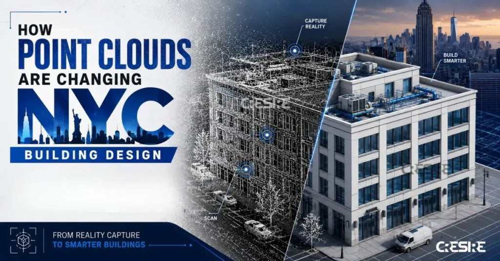
Renovating an existing building in New York often starts with an information problem.
The drawings may show where a wall was supposed to be. The site may tell a different story.
Years of tenant improvements, structural modifications, replacement MEP systems, façade work and undocumented alterations can leave architects and engineers working with drawings that no longer fully represent the building. In a renovation project, a difference of a few inches can affect a new wall layout, ceiling height, duct route, structural opening or equipment location.
This is where point cloud modeling in New York is becoming increasingly useful.
Laser scanning provides a measured record of existing conditions. Point cloud modeling then turns that captured information into usable 3D geometry and, where required, a structured BIM model in Revit. Instead of designing from assumptions and discovering discrepancies during construction, project teams can begin with a much clearer understanding of what is actually there.
The important distinction is that a point cloud is not a BIM model. The scan captures the building; the BIM process interprets that information into architectural, structural and MEP elements that can support design, coordination and construction decisions.
What Is Point Cloud Modeling in New York?
Point cloud modeling in New York is the process of developing a digital 3D or BIM representation of an existing building from laser-scanned point cloud data.
Laser scanners capture millions of spatial points from the building. When multiple scans are registered together, they create a detailed point cloud representing the physical environment.
The modeling team then uses that information as a reference to develop building elements such as:
- Walls
- Floors and slabs
- Ceilings
- Doors and windows
- Roofs
- Stairs
- Columns and structural elements
- Building façades
- Openings
- Visible MEP systems
- Other project-specific components
The final model can be developed in Revit or another BIM platform according to the project’s requirements.
But this isn’t simply a matter of converting one file format into another.
The scan captures reality. The BIM model interprets reality.
That distinction becomes particularly important when the model will be used for renovation, retrofit, structural modifications or multidisciplinary coordination.
Why Existing Building Design Is Different in New York
New York has an enormous variety of existing building stock, from older residential and commercial buildings to industrial properties, institutional facilities, high-rise developments and buildings that have gone through several generations of renovation.
That creates a common challenge for design teams: the current building may not match its historical documentation.
An architect may receive a set of CAD drawings from a previous renovation. They may be useful, but that doesn’t necessarily mean they accurately represent every condition visible on site today.
A partition could have moved. A ceiling could have been lowered. An opening could have been enlarged. A mechanical system could have been rerouted. A structural element may not be exactly where the old drawing indicates.
These differences become important when new design work has to fit around the existing structure.
For example, moving a partition by several inches may appear insignificant at the planning stage. But once that change affects a door, ceiling grid, lighting layout, HVAC route and plumbing connection, the small discrepancy becomes a coordination issue.
This is why reliable existing-condition information is so valuable.
Point Cloud Modeling Gives AEC Professionals a Measured Starting Point
Traditional field measurement can still be appropriate for smaller or straightforward projects.
But larger buildings and complex renovation projects can contain too many interconnected conditions to document efficiently through isolated measurements alone.
Laser scanning captures the building as a spatial dataset.
The design team can then inspect that information in the office rather than relying entirely on notes and photographs from the site.
That doesn’t eliminate site verification. It gives the project team a much stronger reference before design decisions are made.
From Laser Scan to BIM: How the Workflow Works
A typical laser scanning to BIM workflow can be summarized as:
Laser scanning → Scan registration → Point-cloud processing → Coordinate verification → Revit linking → BIM modeling → Coordination → QA/QC
Every stage affects the final result.
A high-quality scan can still produce a poor BIM model if the scans aren’t properly registered or the modeling scope is unclear. Likewise, a well-modeled Revit project can still be problematic if the point cloud was incorrectly positioned.
Let’s look at the process more closely.

1. Capture the Existing Building
The process begins with laser scanning.
Multiple scan positions are normally required to capture the building from different locations. Depending on the project scope, scanning may capture architectural surfaces, structural elements, ceilings, façades, equipment and visible MEP systems.
The scanner doesn’t know that a group of points represents a wall or a door.
It simply records their spatial position.
The interpretation happens later.
This is an important distinction because the quality of the final BIM model depends not only on the scanning equipment, but also on how the captured information is processed and interpreted.
2. Register the Scans
A large building generally requires multiple scans.
Those scans need to be aligned into a common coordinate framework so that they form one coherent representation of the building.
This is known as registration.
Poor registration can create apparent offsets or inconsistencies that later look like problems with the building itself.
For that reason, registration should be treated as a critical quality-control stage rather than a routine file-processing task.
3. Clean and Prepare the Point Cloud
Raw scan data can contain information that isn’t necessary for the BIM model.
People, temporary equipment, redundant points and other irrelevant data may need to be removed or organized.
Autodesk ReCap supports point-cloud registration, cleaning, cropping, organization and classification, as well as conversion into RCP/RCS formats used in Autodesk workflows.
The objective isn’t simply to make the file smaller.
It is to create a point cloud that is practical to work with while retaining the information required for the project.
4. Establish Coordinates
Before detailed modeling begins, the point cloud needs to be positioned correctly within the project environment.
Depending on the project, this may involve:
- Survey coordinates
- Shared coordinates
- Project base point
- Building orientation
- Levels
- Elevation references
- True north and project north
This stage is easy to overlook.
It shouldn’t be.
A point cloud can be extremely accurate and still be in the wrong location relative to the BIM model.
For multidisciplinary projects, coordinate management becomes even more important because architectural, structural and MEP models need to share a reliable spatial reference.
5. Link the Point Cloud Into Revit
For projects using Revit, the prepared point cloud can be linked into the project as a reference for modeling.
Autodesk’s current documentation states that Revit and other supported programs use indexed RCP/RCS point clouds. ReCap Pro can be used to index the source data before it is linked into Revit.
Once the point cloud is visible in Revit, the BIM modeler can work through the building systematically.
Plans can be used to establish wall and opening locations.
Sections can help determine floor-to-floor relationships, ceiling heights and vertical geometry.
3D views allow more complex areas to be inspected from different angles.
The workflow becomes much more than tracing a 2D drawing.
The modeler is interpreting a measured three-dimensional environment.
Point Cloud to Revit: Turning Existing Conditions Into a BIM Model
Point cloud to Revit is one of the most common workflows for turning laser-scanned existing conditions into a structured architectural BIM model.
The process usually starts with the major building framework.
Levels and primary geometry are established first, followed by elements such as:
- Exterior walls
- Interior partitions
- Floors
- Ceilings
- Doors
- Windows
- Roofs
- Stairs
- Columns
- Major architectural features
The exact scope depends on the project.
A model for an early renovation study may not require the same detail as one being used for construction coordination.
This is where LOD becomes important.
A higher level of detail isn’t automatically better.
If the project only requires accurate wall locations, openings, floor levels and major architectural elements, modeling every decorative feature may add time without adding useful information.
On the other hand, a heritage restoration project may require considerably more detail because architectural irregularities and decorative elements are part of the design problem.
The model should therefore be developed according to its intended use.
Architectural Point Cloud Modeling Requires More Than Tracing

A point cloud can contain millions or even billions of points.
That doesn’t mean the BIM model should contain millions of modeled elements.
This is where professional judgment comes into play.
Imagine an existing wall with a slightly uneven surface.
Should the Revit wall reproduce every variation?
Usually not.
If the project is a general renovation, a representative wall plane may be entirely appropriate.
But if the irregularity affects a new façade connection, structural modification or heritage feature, it may need to be represented more carefully.
Architectural point cloud modeling is therefore an interpretation exercise.
The BIM team needs to understand:
- What the element is
- How accurately it needs to be represented
- Which geometry matters to the project
- What LOD is required
- How the element will be used later
That is one reason point cloud modeling shouldn’t be treated as a simple automated conversion.
Where Point Cloud Modeling Creates the Most Value
1. Building Renovation
Renovation projects are perhaps the most obvious application.
The design team needs a reliable understanding of existing walls, openings, floors, ceilings, structural elements and other conditions before introducing the proposed design.
A point-cloud-based BIM model gives the architect a measurable digital reference.
2. Adaptive Reuse
An industrial or commercial building may be converted into offices, residential space, hospitality, education or another use.
The building may have irregular floor plates, old structural systems and complicated service routes.
Before deciding what can be changed, the design team needs to understand what already exists.
Point cloud modeling provides that starting point.
3. Historic and Older Buildings
Older buildings can contain geometry that doesn’t conform neatly to modern assumptions.
Walls may not be perfectly straight. Floors may vary in elevation. Openings may have unusual dimensions. Façades may contain significant decorative features.
Laser scanning can capture these conditions, while BIM modeling allows them to be organized into a usable digital environment.
4. Commercial Interior Renovation
Tenant improvements can involve a surprisingly large amount of existing-condition coordination.
New partitions may need to work around existing columns, ceiling systems, electrical infrastructure and HVAC routes.
A reliable existing model can help design teams understand those constraints before the construction phase.
5. Structural Retrofit
Existing structural conditions are particularly important when new openings, extensions, equipment or loads are being considered.
Point-cloud data can help document visible structural geometry and provide another reference for the structural engineering team.
It doesn’t replace engineering investigation or analysis, but it can improve understanding of the physical environment.
6. MEP Renovation
Existing services can be difficult to document, especially in congested ceiling spaces and plant areas.
Where the scan captures visible systems within the agreed scope, the data can support MEP BIM modeling and coordination.
This becomes particularly useful when new services must fit around existing structure and architecture.
Why a Point Cloud Is Not the Same as a BIM Model
This distinction deserves emphasis. A point cloud is primarily measured spatial data.
A BIM model is structured building information. The point cloud tells you where surfaces and objects were captured.
The BIM model tells you what those objects are intended to represent within the project environment.
For example:
Point cloud: A dense group of points showing a vertical surface.
BIM interpretation: An exterior wall with a defined location, thickness, height, category and other project parameters.
The BIM model therefore adds structure and meaning to the captured geometry.
That is why point cloud modeling requires more than software capable of displaying scan data. It requires someone who understands the building and the purpose of the model.
How Accurate Should a Point Cloud to BIM Model Be?
There isn’t one accuracy level that applies to every project. The required accuracy depends on:
- Scanner capability
- Survey control
- Registration quality
- Point-cloud density
- Site conditions
- Occlusions
- Modeling methodology
- LOD
- Project tolerance
- Intended use
This is an important distinction because the scanner’s accuracy and the BIM model’s accuracy are not necessarily the same thing.
A point cloud may capture a surface with very high density, while the BIM model intentionally represents that surface using a simplified wall element.
That can still be the correct result.
The question should be:
Is the BIM model accurate enough for the decisions and deliverables it needs to support?
For a conceptual renovation model, the answer may be different from a construction-coordination model.
What Should You Define Before Starting a Point Cloud Modeling Project?
Before commissioning a scan or starting the modeling process, the project team should establish several requirements.
Requirement | Why it matters |
Model purpose | Determines what needs to be modeled |
LOD | Defines the expected level of geometry and information |
Accuracy/tolerance | Establishes acceptable deviation |
Coordinate system | Prevents alignment problems |
Model scope | Defines architectural, structural and MEP elements |
Deliverables | Establishes required file formats and documentation |
This sounds administrative, but it can have a significant effect on project cost and schedule.
A client asking for an “accurate as-built BIM model” without defining what accurate means leaves an important requirement open to interpretation.
The better approach is to define the intended use before modeling begins.
How Much Does Point Cloud Modeling Cost in New York?
There isn’t a meaningful single price for point cloud modeling in New York because project requirements can vary considerably.
The modeling effort can depend on:
- Building size
- Number of floors
- Geometry complexity
- Point-cloud quality
- Required LOD
- Architectural scope
- Structural scope
- MEP scope
- Number of modeled elements
- Required accuracy
- Deliverable format
- Coordination requirements
- Turnaround time
For example, two buildings with the same floor area can require very different modeling effort.
A simple open commercial space may be relatively straightforward.
A multi-level historic building with irregular geometry, complex MEP services and multiple architectural features can require substantially more interpretation and QA/QC.
For this reason, project teams should request a scope-based quotation rather than comparing providers purely on a price per square foot.
What's Changing in Point Cloud Workflows in 2026?
Point-cloud technology continues to evolve.
One notable development is Autodesk’s enhanced ReCap Pro 2026 workflow, which includes scan-to-mesh capabilities and integration that allows segmented mesh geometry to be brought into Revit as Revit families. Autodesk positions these tools as a way to make modeling complex scanned elements more efficient.
This is useful for certain complex objects and geometry.
But it doesn’t mean that a point cloud can simply be converted into a complete architectural BIM model with no human involvement.
A mesh represents geometry.
A BIM model also needs structure, categories, relationships, parameters and project-specific interpretation. Automation can reduce repetitive work. It doesn’t eliminate the need for architectural and BIM judgment.
That distinction is likely to become even more important as reality-capture and AI-assisted modeling tools continue to develop.
Point Cloud Modeling Is Changing the Way Existing Buildings Are Designed
Perhaps the biggest change isn’t the scanner itself.
It is the shift from designing from assumptions to designing from measured existing conditions.
- For architects, that can mean greater confidence when developing renovation layouts.
- For structural engineers, it can provide a better understanding of existing geometry.
- For MEP engineers, it can reveal constraints around existing services.
- For contractors, it can provide a clearer picture of what they are going to encounter before construction begins.
- For owners, it can create a useful digital record of an existing asset.
The point cloud captures the building as it exists.
The BIM model turns that captured information into something the project team can work with.
That is the real value of the workflow.
Final Thoughts
Existing buildings rarely behave like their original drawings.
That is especially important on renovation and retrofit projects, where new design decisions have to fit within physical conditions that may have changed over decades.
Point cloud modeling in New York provides architects and AEC teams with a practical way to bridge that gap.
Laser scanning captures the existing environment. Point-cloud processing organizes the data. Revit and other BIM platforms provide the environment for developing structured building information. QA/QC then verifies that the model remains aligned with the source information.
But technology is only part of the equation.
The real value comes from knowing what to model, how accurately to model it, and what the project will use the model for.
A good point cloud model isn’t the one with the most geometry.
It is the one that gives the project team enough reliable information to make better decisions before those decisions become expensive to change.
How CRESIRE Supports Point Cloud Modeling in New York
At CRESIRE, we support architects, engineers, contractors, developers and project owners with point cloud modeling in New York and other international markets.
Our teams work with laser-scanned point-cloud data to develop architectural, structural and MEP BIM models for existing buildings, renovation, retrofit, adaptive reuse and coordination projects.
Depending on the project requirements, our workflow can include:
- Point-cloud review and preparation
- Architectural point cloud modeling
- Point cloud to Revit modeling
- Existing-condition BIM development
- Structural BIM modeling
- MEP BIM modeling
- Scan to BIM coordination
- QA/QC against point-cloud data
- LOD-based BIM development
- As-built documentation
The objective is not simply to reproduce scan data in 3D.
It is to develop usable BIM information that supports the next project decision—whether that is renovation design, structural assessment, MEP coordination, construction planning or facility documentation.
For projects requiring broader BIM modeling support, point-cloud-derived models can also be integrated into multidisciplinary workflows.
NDA available