

IN THIS BLOG
SHARE
Introduction
When you are designing a building you start with a pretty blank page.. When you are working with a building that already exists it is not that simple. Whether you are doing a renovation or an extension or something else you have to ask yourself this question: what is the Point Cloud to 3D Model of the building like?
You can look at the drawings of the building but the thing is, buildings change over time. For example the services like plumbing and electricity get moved around walls get taken down. Put up and equipment gets replaced.. A lot of the time these changes are not added to the original drawings of the building.
This can cause problems for architects and engineers who are working on the building. They can make a design that’s technically correct but it can still cause trouble because it is not based on the current state of the building.
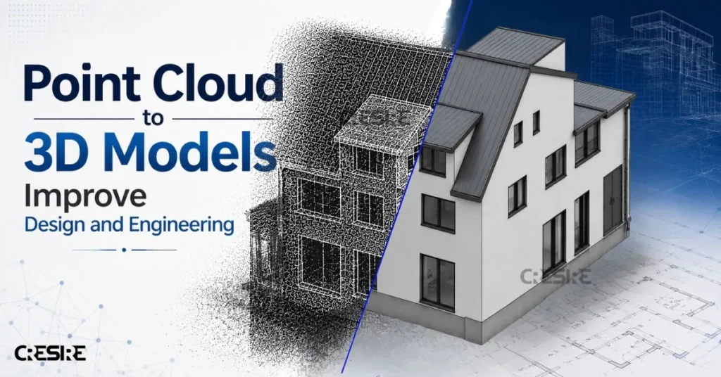
That is where using Point Cloud to 3D Model workflows can be really helpful.
- Laser scanning and other methods can take millions of measurements of the building. Create a Point Cloud.
- Once this Point Cloud is processed and turned into a model the people working on the project have a much better understanding of the building.
They can see the shape of the building, the levels, the structure of the building, the services like plumbing and electricity, the equipment and the space that is available.
In the year 2026 this is more important than it was a year ago. People are using Building Information Modeling or BIM in the process, and they need to have accurate measurements. When you are renovating a building, you need to have a schedule and the design team needs to be able to make decisions without having to visit the site many times.
So the value of using Point Cloud to 3D Model is not just that it creates a picture of the building. The Point Cloud, to 3D Model is really useful because it helps people understand the building and make decisions. It reduces the amount of guessing that happens before design begins.
1. Design Decisions Start with Better Existing-Condition Information
Imagine an architect developing a refurbishment scheme using drawings prepared fifteen years ago.
The drawings show what was intended to be constructed. They don’t necessarily show what was built or what has changed since.
A Point Cloud to 3D Model gives the design team a reference based on captured site conditions rather than assumptions carried forward from legacy documentation.
This becomes particularly useful when working with irregular buildings, older structures, industrial facilities, heritage properties, or spaces that have undergone several modifications.
Walls, columns, openings, floor levels, ceiling heights, roof geometry, and other visible elements can be modeled against the captured point cloud.
For architects, that means fewer assumptions during design development. For engineers, it creates a more dependable starting point for evaluating how proposed systems will interact with the existing building.
2. Complex Geometry Becomes Easier to Understand
Not every building fits neatly into a set of orthogonal drawings.
Older structures may contain sloping floors, irregular walls, non-standard roof profiles, deflected structural members, or architectural features that are difficult to document using conventional measurements alone.
This is where point cloud data becomes particularly useful. Instead of reducing existing conditions immediately into a handful of dimensions, reality capture preserves the spatial relationship between building elements. During point cloud modeling, this information can then be interpreted into usable architectural, structural, or MEP geometry at the required level of detail.
This doesn’t mean every millimetre of scan data needs to become model geometry. Good modeling still requires judgement about what information matters for the intended use.
And that distinction is important.
A model prepared for early architectural planning may require a different level of detail from one being used for MEP coordination, fabrication planning, or heritage documentation.
Accuracy becomes far more useful when it is tied to purpose.
3. Renovation Designs Can Be Tested Against Existing Conditions
Renovation projects are where inaccurate information becomes expensive very quickly.
A proposed duct route might work perfectly in the design model but conflict with an existing beam. New equipment may fit within a plant room on the drawing but leave inadequate installation or maintenance clearance.
With an accurate 3D digital model of existing conditions, proposed design information can be reviewed against the building much earlier.
Architectural interventions can be checked against existing geometry. Structural engineers can better understand interfaces between new and existing elements. MEP teams can assess available routing space before developing services too far.
This doesn’t eliminate every unknown condition—no survey or model can expose what hasn’t been captured or is concealed but it gives teams substantially better information for the conditions that can be documented.
That difference matters. It moves many coordination conversations from the construction site back into the design environment, where changes are generally easier to evaluate.
4. BIM Coordination Becomes More Relevant to the Real Building
A coordinated BIM model can still produce poor outcomes if the existing building underneath it is inaccurate.
This is particularly important for retrofit projects involving dense MEP services.
Consider a plant room where new mechanical equipment, electrical containment, pipework, and fire protection systems need to be integrated around existing installations. If existing service locations are based on outdated drawings, clash detection may show a perfectly coordinated design that simply doesn’t correspond with reality.
Using Point Cloud to 3D Model workflow changes that starting point.
Existing visible conditions can be represented within the BIM environment, while proposed models are developed and coordinated around them. Clash detection then becomes more meaningful because teams are comparing proposed systems against a better representation of the space they will actually encounter.
For contractors and BIM coordinators, this can mean fewer surprises when coordinated information reaches the site.
5. Better Information Supports Prefabrication and Installation Planning
The growth of off-site fabrication has made dimensional reliability increasingly important.
A traditional site installation may allow trades some flexibility to adjust routing or dimensions as work progresses. A prefabricated assembly offers much less room for improvisation.
Pipe modules, duct assemblies, supports, and other components may be manufactured before they reach the project site. If the dimensions or connection locations they rely upon are wrong, the problem has already moved beyond design coordination.
Accurate point cloud information can help teams verify existing interfaces before fabrication decisions are made.
It can also support access studies, equipment replacement planning, and installation sequencing in constrained existing facilities.
This is an important change in how we should think about point cloud modeling. Its value doesn’t stop with design accuracy. Reliable existing-condition information can influence how confidently downstream construction decisions are made.
6. Fewer Site Visits Doesn't Have to Mean Less Site Understanding
One practical benefit that sometimes gets overlooked is access to the captured building after the survey is complete.
Design teams are often geographically distributed. Architects may be in one city, engineers in another, and specialist BIM teams somewhere else entirely. Returning to site every time somebody needs a missing dimension is inefficient and on operational hospitals, factories, airports, or secure facilities, it may not always be practical.
A detailed point cloud creates a digital record that teams can revisit.
Engineers can interrogate areas that weren’t initially considered important. Architects can verify spatial relationships during later design stages. BIM teams can refer back to the source data while developing or checking models.
It doesn’t replace every site investigation.
But it can reduce the number of occasions where someone has to travel to site simply because the project information doesn’t answer a basic geometric question.
7. The Model Can Continue to Provide Value After Design
There is another reason the quality of the initial 3D model matters: the information may eventually be used by people who had nothing to do with the original design.
After construction or refurbishment, building owners and facility teams may use updated BIM information for asset management, maintenance planning, future alterations, space management, or subsequent renovation projects.
An accurate existing-condition model therefore has the potential to become more than a design input.
It can form part of the building’s evolving digital record.
The important point is not to model everything simply because the technology allows it. The model should contain the geometry and information required for its intended uses, with clear expectations around accuracy, Level of Detail (LOD), Level of Information Need (LOIN), and deliverables established before modeling begins.
That approach keeps the model useful without making it unnecessarily complicated.

Accuracy Is Not About Creating the Most Detailed Model
This is perhaps the most important point for AEC teams considering Point Cloud to 3D Model workflows in 2026.
More detail doesn’t automatically mean more accuracy. A successful project starts by understanding what the model will actually be used for.
An architect developing an early renovation concept doesn’t necessarily need every pipe fitting modeled. An MEP contractor coordinating a congested plant room might. A facility manager may care more about equipment locations and asset information than architectural finishes.
The right question isn’t: “How detailed can we make the model?”
It is: “What information does the project team need to make reliable decisions?”
Once that is clear, the point cloud can be converted into a model that is accurate for its intended purpose, rather than simply being visually impressive.
How CRESIRE Supports Point Cloud Modeling
At CRESIRE, we work with architects, engineers, contractors, surveying companies, and project owners to convert client-provided point cloud data into architectural, structural, and MEP BIM models for renovation, retrofit, coordination, and existing-building projects.
Our teams work with commonly used point cloud formats such as RCP and E57 and develop project-specific Revit models based on the required scope, LOD, accuracy requirements, and intended downstream use.
The objective is straightforward: provide project teams with reliable digital building information they can actually use for design, engineering, coordination, and construction decisions.
Final Thoughts
Point cloud technology has changed the way AEC teams document existing buildings, but the real improvement isn’t the scanner, the software, or even the 3D model itself.
It’s the quality of information available when somebody needs to make a decision.
For renovation and retrofit projects, that might mean understanding whether a new design fits within an existing structure. For engineers, it may mean knowing where existing systems actually run. For contractors, it could mean verifying dimensions before fabrication or installation begins.
A Point Cloud to 3D Model is really important because it helps connect what is actually at the site with what the designers are working on. As we get closer to 2026 the design, coordination, fabrication and construction of a project are all going to be connected.
So it is very important to have an understanding of what is already at the site. Having an understanding of the Point Cloud to 3D Model is not just nice to have, it is something we need to have to do our jobs correctly and deliver good work with the Point Cloud to 3D Model.
NDA available