





Home Services Scan to CAD Point cloud to precision
Professional Scan to CAD Services for Accurate As-Built Drawings.
CRESIRE converts 3D laser scan data into editable architectural, structural and MEP CAD drawings. We provide Point Cloud to CAD Services suitable for renovation, retrofit, facilities management and clash coordination of AEC projects.
- LOD 200 to 400 modeling, as specified
Trusted by AEC Professionals


See what’s already there
What Are Scan to CAD Services?
Scan to CAD services involve converting building, physical objects, equipment and architectural spaces into precise editable 2D CAD drawings that are used by AEC professionals for various applications such as renovation planning, facilities management and coordination.
Professional laser surveyors use terrestrial laser scanning devices to capture visible building surfaces as millions of measured points, register and share the point cloud data in E57 and RCP formats.
Our Point cloud to CAD conversion services this 3D laser scanned data into structured 2D architectural, structural and MEP drawings. This includes floor plans, elevations and sections that give your team a dependable picture of the existing building.
Architects, engineers and contractors use these existing-condition drawings to plan renovations, coordinate upgrades and document facilities.
Unlike Scan to BIM, which creates an information-rich 3D model, Scan to CAD delivers drawing-based documentation.
Our Services
From 3D Laser Scan to CAD Drawings
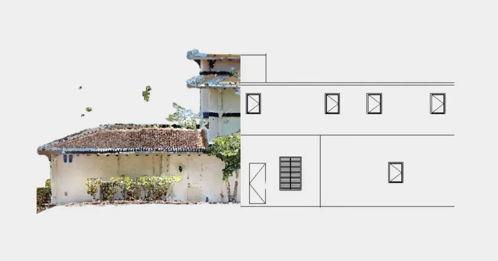
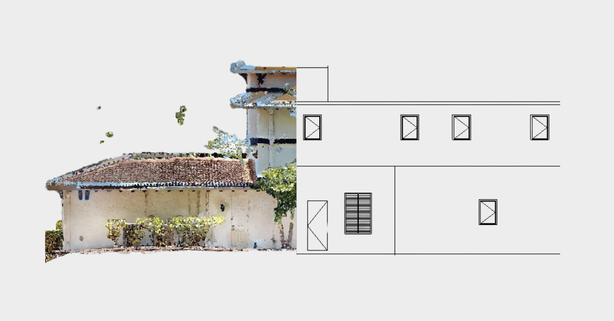
See how a building’s captured surfaces become clear, usable CAD documentation. Our elevation comparison places the scanned building next to its CAD interpretation, so you can judge the accuracy yourself.
Registered Point Cloud
CAD Drafting & Interpretation
Editable CAD Drawing
Point Cloud to AutoCAD Conversion
Laser Scan to CAD Conversion
As-Built CAD Drawing Services
Captured reality → interpreted geometry
From 3D Laser Scan to CAD Drawings
CRESIRE’s published elevation comparison shows captured building surfaces alongside their CAD interpretation.
Registered point cloud
Surveyed points capture visible surfaces and existing dimensions.
CAD drafting & interpretation
Reference planes and drawing conventions turn scan geometry into documentation.
Editable CAD drawing
Layered geometry, dimensions and annotations support the next design stage.
CAD Drawing Deliverables and File Formats
Clean layers. Clear dimensions. Editable files.
You receive a drawing set built around your brief, organised so it’s ready to use the day it arrives, whether for design, coordination, or facility management.
DWG
Editable CAD
DXF
Editable CAD
Review & share
- 2D floor plans
- Cross sections
- Site plans
- MEP layouts
- Building elevations
- Reflected ceiling plans
- Structural drawings
- Existing-condition drawings
Point Cloud File Formats We Support
Share your available dataset for review. Registration, units, scan coverage and compatibility are checked before the drafting scope is confirmed.
E57
Point cloud data
RCP / RCS
Point cloud data
LAS / LAZ
Point cloud data
PTS
Point cloud data
XYZ
Point cloud data
From capture to clarity
Our Scan to CAD Conversion Workflow
Every drawing we issue traces back to the point cloud it came from. Here is how we get from your scan data to a checked, editable drawing set.
Review your brief
Check registration
Set up CAD references
Draft each discipline
Check & deliver
Built around your sector
Industries We Serve
Architecture & design firms
Healthcare & hospitality
MEP consultants
Multi Storey Commercial Building
Applications of Scan to CAD Services
Turn Existing Conditions into Accurate, Actionable CAD Drawings
Convert real-world site conditions into precise, editable CAD drawings that support renovation, retrofitting, architectural design, structural modifications, and facility management.
Our Scan to CAD services help architects, engineers, contractors, and facility managers work with reliable existing-condition documentation, reduce measurement uncertainties, and make informed project decisions.
- Commercial building renovations
- Existing facility documentation
- Industrial plant modifications
- Historic building restoration
- MEP system upgrades
- Building extensions & retrofits
- Facility management documentation
Why Choose CRESIRE for Scan to CAD Services?
Share your project files with our team for an initial review. We’ll check your drawings, scan data, measurement units, site coverage, and file formats to understand your requirements and confirm the right scope for your Scan to CAD project.
AEC domain knowledge
A point cloud records everything in a space, including things nobody wants on a drawing. Our team has architecture and engineering backgrounds, so we know what to draw, what to leave out and how to show what’s really there.
Multidisciplinary, Editable Drawings
Architectural, structural and MEP drawings come from the same point cloud, so the sets agree with each other. Files arrive as layered DWG with clear dimensions and agreed conventions, ready to edit and build on.
Scan Data Expertise
Point clouds arrive in all sorts of formats depending on the scanner and survey team. We work with E57, RCP, RCS, LAS and PTS files, so whatever you send, we can open it, check it and get it ready for drafting.
Georeferencing Knowledge
We understand coordinate systems and survey control, so your drawings sit in the right place. They line up with site surveys, existing drawings and neighbouring project data without anyone having to nudge them into position.
Defined QA/QC procedures
We check registration and coverage before drafting starts. Before delivery, we check dimensions, layers and completeness against the point cloud and your brief. If something’s off, we’d rather find it than have your site team find it.
ReCap Pro and AutoCAD Skills
We register, clean and prepare point clouds in Autodesk ReCap Pro, then draft in AutoCAD with the cloud referenced directly. Every line is drawn against real data, so you aren’t getting a best guess.
Real scans. Real projects.
Recent Scan to CAD Projects and Case Studies
Testimonials
Trusted by Construction Leaders Worldwide
Very Responsive! A new client and project were made possible by one of your models that I shared with one of my clients’ coworkers. Undoubtedly, the best BIM Consulting and Services provider.
Confidential
Tim-Surveyor, USA
Cresire’s team is very responsive and easy to work with. Quick turnaround time. Would definitely partner with them again.
Peter
Guam, USA
Devashish and Cresire did a great job for me generating electrical drawings in .dwg format from my rough drawings and other materials. Fast, efficient and good value.
Paul Scott
Engineer, Australia
FAQ
Frequently asked questions
What are Scan to CAD services?
What is the difference between Scan to CAD and Scan to BIM?
What point cloud formats do you accept?
Can you convert point cloud data into editable DWG drawings?
What architectural drawings can be created from laser scan data?
Can you provide structural and MEP Scan to CAD services?
How accurate are Scan to CAD drawings?
How long does Scan to CAD conversion take?
What CAD deliverables will I receive?
How can I get a quote for Scan to CAD services?
24-HOUR QUOTE RESPONSE
Get Started with Professional Scan to CAD Conversion
From scoping the first model to final handover — get a delivery plan tailored to your construction programme within 24 hours.
enquiry@cresireconsulting.com
NDA available
