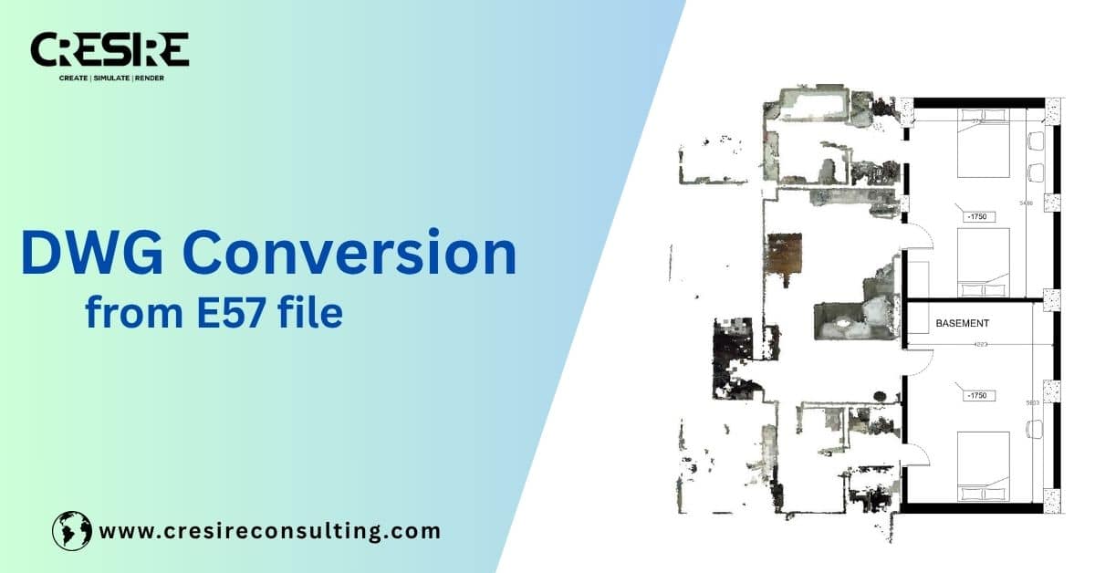
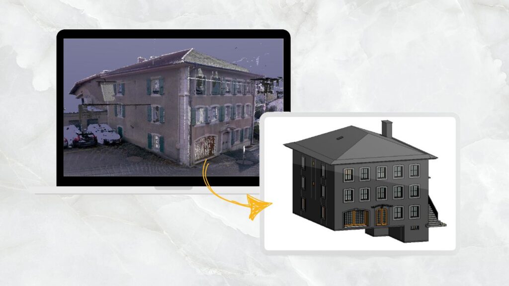
If you are working with laser scan data, chances are you have received an E57 file and wondered how to open it in AutoCAD or convert it into usable DWG drawings. Since AutoCAD does not directly support E57, the file must first be converted into RCP or processed through a structured workflow. In this guide, we will explain how to convert E57 to RCP, how to import it into AutoCAD, and how professionals turn point cloud data into accurate CAD drawings using structured SCAN TO CAD SERVICES.
Table of Contents
What is an E57 File and Why Convert It to DWG?
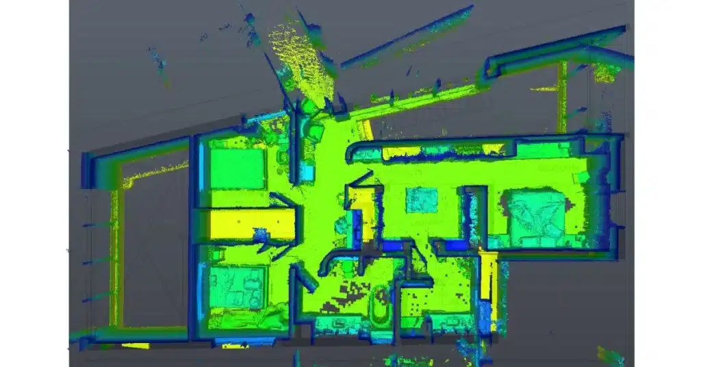
An E57 file is an open, vendor-neutral format used to store 3D laser scan data. It typically contains Millions or billions of point cloud coordinates, RGB color data, Scan position information and Metadata from LiDAR scanners.
E57 files are commonly exported from software such as Leica Cyclone, Faro Scene, and other reality capture platforms.
If you’ve ever worked with laser scan point cloud data, you would have probably come across a file with the .e57 extension. It is actually a smart, vendor-neutral container that holds 3D point cloud data captured from laser scanners. Basically, it is a digital walkthrough of reality, providing comprehensive design details.
However, E57 files are not directly compatible with most conventional software such as Autocad, making them difficult to use without conversion or preprocessing. That’s a challenge if you’re trying to build floor plans, elevations, or technical documentation. So, that’s where DWG conversion from E57 file becomes critical for bridging the gap.
We see DWG files as a common language for CAD draftmen and AEC professionals. DWG drawings are widely compatible, editable, and neatly structured, making them the ideal format for architects, engineers, and contractors. E57 Scan to dwg conversion file is an important bridge between raw 3D point cloud data and actionable design documentation.
Architectural Scan to DWG Services: Who Needs Them?
Let’s see below the primary AEC professionals who need scan to architectural dwg services:
- Architects need accurate as-built drawings for renovations or adaptive reuse. Developing a detailed DWG conversion from E57 point cloud means there is no guesswork during renovations especially for design sizes and locations
- Contractors use e57 point cloud to 2d dwg cad services for validating existing conditions before demolition and rebuilding. They are more interested in knowing the existing conditions for strategising site construction
- Real Estate Developers often need detailed dwg drawing from E57 point cloud layouts for feasibility studies, planning and making informed investment decisions for renovation.
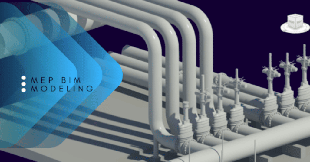
- Engineers, especially MEP professionals, rely on architectural DWG drawings developed from E57 point cloud data for laying out mechanical ducts, electrical conduits, or plumbing lines without clashes.
Also Read:
How Point Cloud to CAD or AutoCAD Conversion Services are helpful to Architects and engineers worldwide for their projects.
Step-by-Step: Convert E57 to DWG in AutoCAD

Converting an E57 to a clean, structured DWG is a methodical process. The process involves an experienced laser surveyor, advanced point cloud registration software and experienced scan to cad specialist. combination of Here’s how it works:
1. Receive the E57 file
Usually the point cloud data is captured by laser scanners like Leica, Faro, or Trimble. These files arrive loaded with millions (sometimes billions) of data points. The number of data points are dependent on the size of project and that impact the overall size of the e57 point cloud data
2. Register and clean the scans
Before processing and registering the point cloud data, these scans need alignment. We “register” them into a single coordinate system and remove noise (think of it like tuning a piano before playing)
3. Import into software
There are many tools such as Autodesk ReCap to convert and visualize the e57 point cloud data. The software requires advanced technical skills to review and assess the data. From here, we develop the RCP file and push it into AutoCAD or Revit software where CAD drafting begins.
4. Draft the 2D CAD drawings
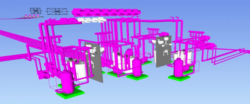
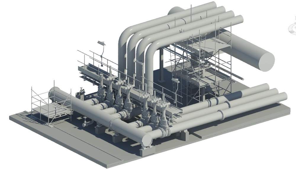
Using the imported RCP developed from E57, we trace the design details in different views such as plan, RCP, elevational and sectional. The 2D CAD drawings from point cloud data can be developed architectural, structural and mep disciplines.
5. Quality control and final output
This is where skilled CAD drafters are required. At this stage, every line is checked, every layer named, and the final file delivered in a neat DWG format (often complying with AIA, BS, or client-specific CAD standards).
What You Get: 2D CAD Drawings from Point Cloud Data

The big question for laser scan to DWG conversion is: what do we get at the end, and how is it useful in design and construction? The 2D CAD drawings developed using E57 point cloud data contain various elements and aspects of design. When combined, they provide detailed information about a building and its site. Below are the important elements of 2D CAD drawings derived from point cloud data.
- Floor Plans: 2D Architectural, structural framing and MEP plans with room labels, wall details, column location, equipment sizing and fixture references
- Elevations: 2D external elevations or interior sections, capturing façade details, window/doors placements, and levels.
- Roof Plans: The plans include slopes, drains, and parapets. Scan-to-DWG plans generally include roof plans integrated with floor plans as part of a complete package.
- RCPs: Reflected Ceiling Plans show ceiling heights, beams, and lighting fixtures.These are important to assess the existing locations of electrical and structural elements.
Why Accuracy Matters in DWG Conversion from E57 File?
When it comes to technical drawings, “close enough” doesn’t cut it. A misaligned wall or a mislabeled elevation can throw off an entire construction sequence. That’s why accuracy is the backbone of Scan-to-DWG services. Drafting from point cloud data requires an understanding of tolerances-what’s acceptable and what’s not. Dimensions must be real-world accurate, and layering and annotations must follow established standards.
And DWG drawings are not just about technical correctness, they are about reusability too. These drawings often pass through multiple hands (architects, engineers, permit reviewers). If they’re not clean and well-organized, they create more confusion than clarity.
If your project involves renovation, retrofit, heritage documentation, or MEP coordination, partnering with Cresire for Point Cloud to CAD Services ensures your DWG files are production-ready.
When Should You Outsource E57 to DWG Conversion?
Alright, here’s the thing, doing this in-house sounds great until you’re neck-deep in 300 million scan points and your CAD team is crying over file crashes.
Outsourcing makes more sense than ever, and here’s why:
- Timeline and Speed: Offshore Point Cloud to 2D drafting teams (like ours) work while you’re sleeping. So, of you are based in the USA, UK, Europe or Australia, you may have your two story residential building converted into a dwg overnight.
- Reduce Production Costs: Why burn your local team’s time on redlining when skilled drafters abroad can do it for a fraction of the cost? Software for AutoCAD point cloud conversion is generally quite expensive. Many small and medium-sized companies with limited Scan-to-AutoCAD conversion needs choose to outsource their requirements to avoid the high cost of software licensing and skilled resources.
- High Quality Standards: Partnering with a professional dwg conversion from e57 data services provider ensures multi-stage quality checks and a good grasp of US, UK and Australian layering standards. The final deliverables contain essential design elements and defined layers.
At Cresire, our SCAN TO CAD SERVICES transform raw E57 point cloud data into clean, structured, and fully layered AutoCAD drawings ready for architectural, engineering, and construction use.
FAQs
Can AutoCAD open E57 files directly?
No. AutoCAD does not support E57 directly. The file must first be converted into RCP format using Autodesk ReCap.
Is there an E57 to RCP converter online?
Professional-grade conversions require desktop processing. Online tools may compromise scan integrity and scale accuracy.
How do I import E57 into AutoCAD?
Convert E57 to RCP using ReCap, then attach the RCP file as a point cloud inside AutoCAD.
Can E57 be converted directly to DWG?
Not directly. The point cloud must be processed and manually drafted into DWG format.
This improves ranking for:
import e57 to autocad
how to open e57 file in autocad
e57 to rcp converter
e57 to dwg
Conclusion
Converting an E57 file into a DWG drawing isn’t just a format change, it’s a translation from raw, unfiltered complex building data into readable, usable design documents. Whether you’re renovating an old hotel, planning a multi-unit redevelopment, or redesigning HVAC systems in a historic structure, starting with a precise and layered DWG drawing sets you on the right foot.
The process of architectural scan to dwg services is complex and requires advanced software and skilled resources for smooth DWG generation.The final deliverables we get include floor plans, RCPs, elevations, and sections. As an architectural or laser scanning company, it is smart to outsource point cloud to DWG conversion services for efficiency, cost-effectiveness, and high-quality standards.

Devashish is Founder/Director at Cresire where he leads BIM services. He holds a bachelor’s degree in Civil Engineering from the University of Sheffield and an MSc in Construction Project Management from The University of the West of England. His vision behind CRESIRE is to provide BIM services, adhering to best practices and procedures, to global customers, helping customers to save extensive production costs and overruns.
Our Recent Projects on BIM Services

Related Posts