Table of Contents
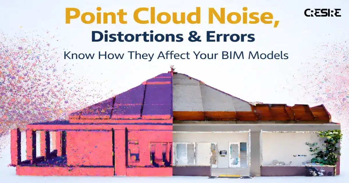
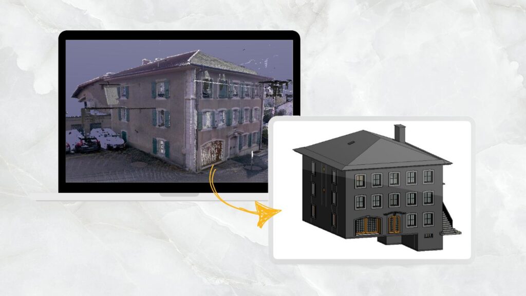
In any Scan-to-BIM project, everything starts with the point cloud. It’s the reference. The base truth. The thing every wall, slab, beam, and pipe is modeled from. When that data is clean and accurate, BIM models fall into place. And when it’s not-problems creep in quietly and show up later where they hurt the most.
Many AEC teams may not be aware of the amount of noise, distortions, or slight scanning errors their point cloud can impact the final BIM model. Most of these problems often go undetected in the initial stages. The model usually seems OK, but then later, when coordination or construction is happening, misalignments begin to show up, quantities seem not to feel right, and trust erodes in the model.
This article breaks down what these point cloud issues really are, why they occur, how they impact BIM outcomes, and how experienced Scan to BIM Modeling teams effectively address them.
Understanding Point Cloud Noise in Simple Terms
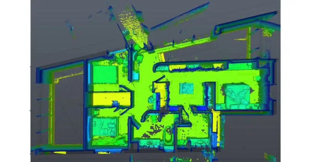
Point cloud noise refers to unwanted or inaccurate data points captured during laser scanning. These points do not represent actual building elements but still exist in the dataset.
Common Causes of noise include:
- Moving objects such as people, vehicles, or machinery
- Reflective surfaces like glass, polished metal, or water
- Long scan ranges or poor scanner positioning
- Environmental factors such as dust or vibration
Noise increases file size, slows down modeling, and creates confusion during element interpretation. If not addressed early, it directly affects model accuracy.
What Are Point Cloud Distortions?
Distortions occur when scanned data does not accurately represent the true geometry of the building. Unlike noise, distortions affect the shape and alignment of real elements.
Typical causes include:
- Inaccurate scanner calibration
- Incorrect scan registration between multiple scan positions
- Poor overlap between scans
- Inconsistent scan angles or heights
Distorted point clouds can make straight walls appear curved, floors appear sloped, or columns appear misaligned. These issues create downstream errors during BIM modeling and coordination.
Common Point Cloud Errors That Impacts BIM Model
Errors are broader issues that arise from a combination of scanning limitations, processing mistakes, and project constraints.
Some common examples:
- Missing data in tight or hidden areas
- Misaligned scans from improper registration
- Incorrect scale or coordinate systems
- Data gaps due to occlusions behind equipment or furniture
Point cloud challenges are often arise due to:
- Rushed scanning without a clear BIM use case
- Low-quality scanning equipment
- Lack of coordination between scanning and modeling teams
- Limited understanding of BIM Level of Detail requirements
How Noise and Errors Affect BIM Models
Point cloud issues do not stay limited to the scan phase. They directly affect BIM quality, usability, and trust.
Reduced Geometric Accuracy
Noisy or distorted data leads to walls, floors, and structural elements being modeled inaccurately. Even small deviations can cause problems during construction or prefabrication.
Clash Detection Failures
When BIM modeling are based on flawed point clouds, clash detection results become unreliable. False clashes increase coordination time, while missed clashes create site-level issues.
Incorrect Quantities and Measurements
Errors in geometry result in inaccurate area calculations, volumes, and quantities. This impacts cost estimation, procurement, and scheduling.
Delays and Rework
Modelers spend extra time interpreting unclear data, and project teams often request revisions when discrepancies are discovered later. This increases turnaround time and project cost.
How Professional Scan to BIM Teams Handle These Challenges

CRESIRE treats Scan to BIM as a process and not a task. Every stage is designed to eliminate errors and protect accuracy in the scan data.
Pre-Scan Planning
Prior to scanning, the scan-to-goals or BIM deliverables must be considered. The project requirements of accuracy and BIM deliverables can affect the scan plan.
Accurate Registration and Validation
A number of scans are precisely matched and verified through the control points and overlap checks. This eliminates distortion and ensures geometry integrity.
Intelligent Point Cloud Cleaning
Noise is filtered using a combination of automated tools and manual review. Temporary objects and irrelevant data are removed without compromising true geometry.
BIM Modeling with Context
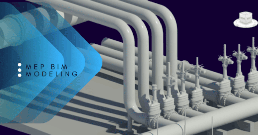
BIM Models are created by experienced architectural, Structural, and MEP BIM Modeling professionals who understand how buildings are constructed. This helps interpret incomplete or complex areas correctly.
Quality Checks at Every Stage
There is a verification of geometry, alignment, and consistency before handover. This can ensure that the BIM model is accurate for design coordination and construction.
What AEC Teams Should Look for in Scan to BIM Deliverables
To avoid problems caused by noisy or inaccurate point clouds, project teams should always confirm:
- Defined accuracy tolerance and modeling standards
- Clear scope for elements to be modeled
- Validation reports or screenshots showing alignment checks
- Experience of the provider with similar building types
Why CRESIRE Is Trusted Globally for Scan to BIM

CRESIRE supports architects, engineers, contractors, and facility owners worldwide with reliable Scan to BIM solutions. Our teams work with complex point cloud datasets across commercial, industrial, healthcare, and infrastructure projects.
WHY YOU SHOULD CHOOSE CRESIRE?
- Deep understanding of point cloud behavior and limitations
- Skilled BIM professionals, not just software operators
- Consistent quality standards across global projects
- Focus on practical, usable BIM models
Noise, distortions, and errors in point clouds are not minor technical issues but directly affect BIM accuracy, coordination, and project outcomes. So ignoring them means delays, rework, and increased costs.
Working with a seasoned Scan-to-BIM partner like CRESIRE enables AEC teams to convert raw point cloud data into accurate and dependable BIM models that support decision-making in the real world.
If the success of your project hinges on accurate existing conditions, investing in quality Scan to BIM is not optional; it is imperative.
Contact our team to discuss and get a free quote for your project.
Latest Helpful Related Articles

Devashish is Founder/Director at Cresire where he leads BIM services. He holds a bachelor’s degree in Civil Engineering from the University of Sheffield and an MSc in Construction Project Management from The University of the West of England. His vision behind CRESIRE is to provide BIM services, adhering to best practices and procedures, to global customers, helping customers to save extensive production costs and overruns.
Our Recent Projects on BIM Services

Related Posts