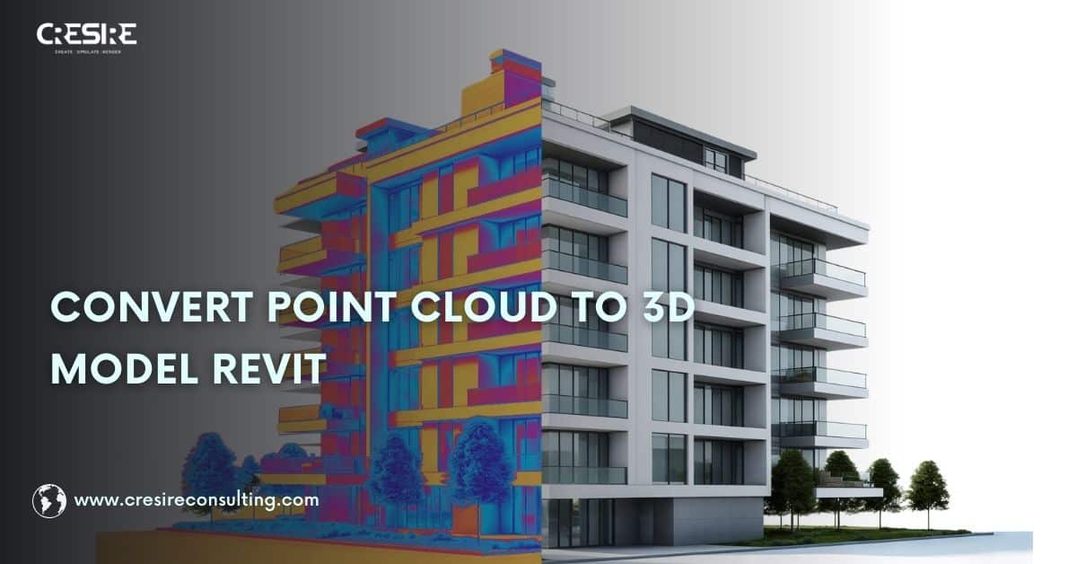
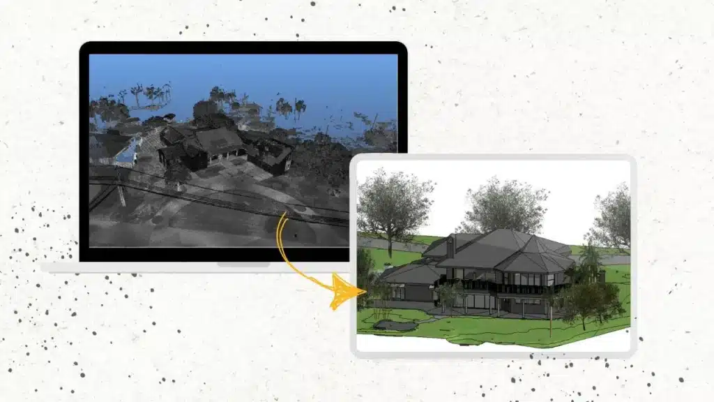
Converting point cloud data into a structured Revit model requires technical expertise, interpretation skills, and BIM domain knowledge. Whether you need to convert a point cloud to 3D model Revit for renovation, retrofitting, or facility documentation, our structured workflow ensures that every Revit model from point cloud data aligns with project standards and LOD requirements. Get in touch with CRESIRE to Convert Point Cloud to 3D Model Revit, the most efficient method for Surveyors, Architects, Engineers, and contractors!
What is Point Cloud?
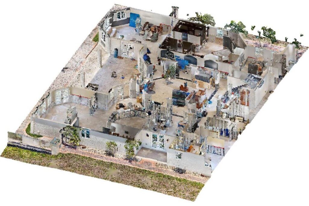
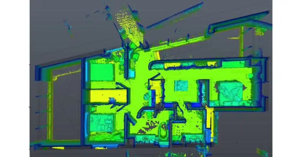
Point cloud data is a collection of million 3D points of a building, landscape or terrain captured by a laser scanner or photogrammetry. Each point cloud is a three-dimensional representation of a particular space with proper X,Y and Z coordinates. Laser surveyors combine each of these point clouds to create a shape of real world spaces i.e., buildings, structure and landscape.
The point cloud data carry accurate geometrical information of building elements, making it useful for Point Cloud to Revit modeling for renovation and facilities management.
The point cloud data is like a building block for point cloud to 3d model conversion. We use software such as AutoDesk Revit for smooth 3d modeling for point clouds. Below is the typical process of how point cloud data actually works:
- Data Capturing: Point cloud data is collected using high precision 3D laser scanners i.e., Faro and Leica.
- Data Composition: Each point contains 3D location and often color.. These points are combined to form a single unified point cloud data to give a complete three-dimensional scan of a building.
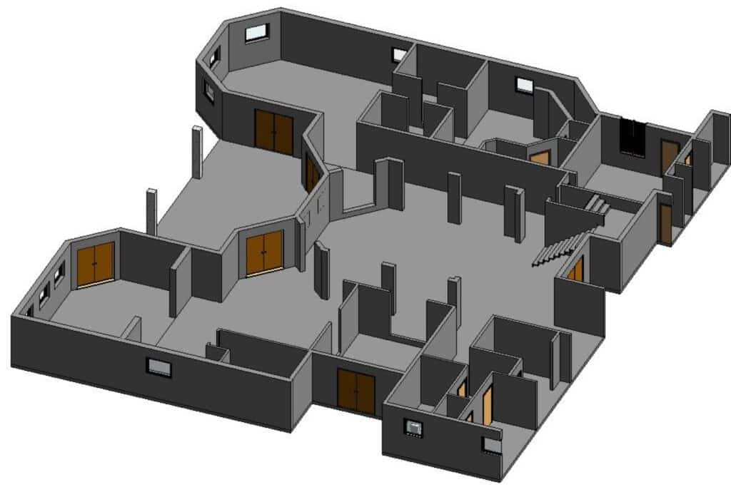
- Setting up Point Cloud: The data is imported into BIM software i.e., Revit. In which we set up the point cloud data by assigning levels, grids and coordinates.
- Point Cloud to Revit Modeling: We used advanced bim software like Revit for converting point cloud into a Revit 3D model that contains the design elements such i.e., the architectural, structural, and MEP of a building.
In the AEC industry, point cloud modeling in Revit plays a great role. The Revit models provide detailed information about the existing structure and site in a collaborative and interactive environment, helping project stakeholders to make informed design and renovation decisions. Project teams are able to reduce errors, save time, and ensure that the design aligns closely with real-world conditions.
Our Process to Convert Point Cloud to Revit Model
CRESIRE uses advanced software, including Autodesk’s Recap Pro, Revit, AutoCAD, and Civil 3D for converting point cloud data to 3D models. Our team of Point Cloud to BIM Model experts helps our customers with developing Revit models and CAD design in multiple disciplines including architectural, structural, and MEP.
See below our Process of How to Convert Point Cloud Data to 3D Model or Point Cloud to BIM Conversion:

1. Importing scanned Point Cloud Data into Recap Pro
Firstly, our Point cloud modeling experts import the laser-scanned data into the readable software to assess the quality and geolocation of the point cloud data. If the quality of the point cloud data is compromised then our team instantaneously get in touch with you.
2. Data Registration and Data Enhancement
We utilize Recap Pro’s registration tools to align multiple scans if necessary. This step ensures the accuracy of your point cloud data. Our team also removes any unnecessary noise or outliers from the point cloud data to enhance its clarity.
3. Exporting Point Cloud Data
We choose the appropriate file format for exporting the cleaned point cloud data. Common formats include LAS and RCS. It is important to adjust export settings to meet the requirements of your BIM modeling software, such as Revit.
4. Importing Point Cloud Data into Revit
We ensure your Revit project is set up correctly for point cloud data integration. We then import the exported point cloud data into your Revit project. This may appear as a reference for your BIM modeling.
5. Convert Point Cloud Data to 3D BIM Model
Once imported, we position the BIM models accurately using the point cloud data as a reference. This ensures alignment with the real-world environment.
We also Add details and annotations to the BIM model based on the point cloud data. This step enhances the model’s informativeness.
GET A FREE QUOTE for your point cloud to Revit model conversion project.
Get FREE Quote
To Convert Point Cloud to Model for Project
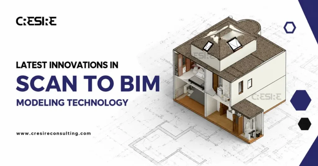
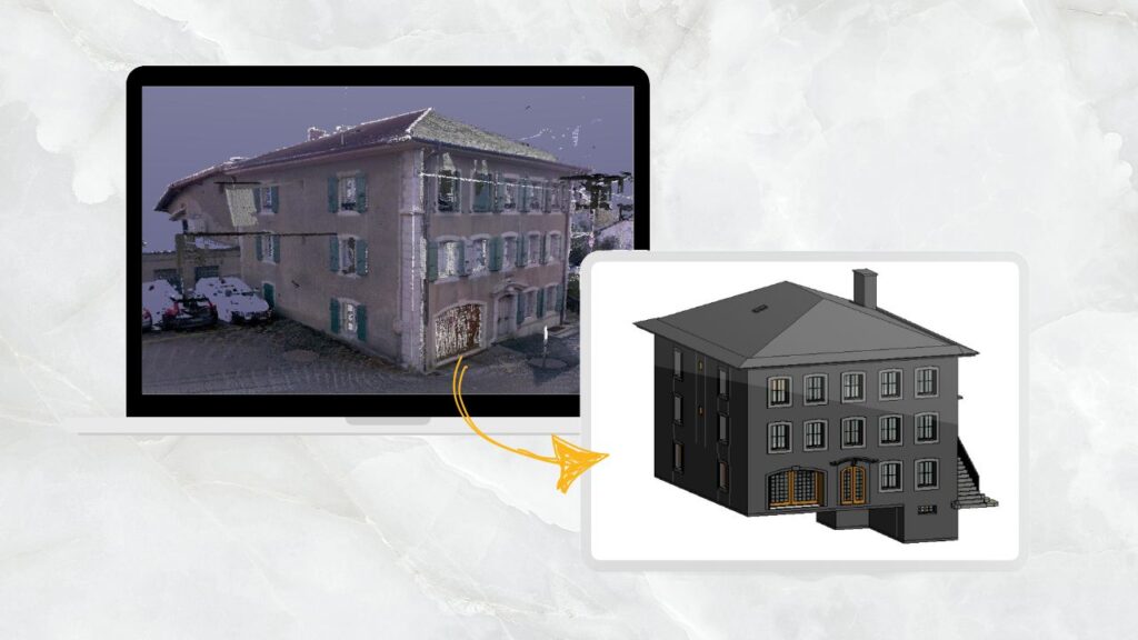
From Scan to Model: Understanding Point Cloud to 3D Conversion in Revit
The process of developing Building information models (BIM) in Architectural, Structural and MEP disciplines is commonly known as Point cloud to Revit modeling. We define the level of detail (LOD) for capturing desired design complexities. For instance, LOD 300 is a basic model with building geometry, whereas LOD 500 is a detailed model with life cycle details of building elements.
With the introduction of Point Cloud data to 3D Models, the AEC industry has significantly improved the process of renovation and historic preservation.
Point Cloud Modeling services facilitate the documentation of as-built design data such as precise dimensions, and locations of design elements, that improves the process of building management. Moreover, we are able to develop BIM ready models for quantity take-offs, cost estimation, and facilities management.
“While Point Cloud Data provides a valuable collection of individual data points captured by laser scanning, it doesn’t directly represent a 3D model. To create a precise and information-rich 3D Model, CRESIRE develops 3D BIM modeling from point cloud data for smooth planning and renovation.”
What are the Benefits of Converting Point Cloud to 3D Model Revit

1. Developing Precise BIM Ready Models
The point cloud data is captured by advanced laser scanners, which is quite accurate. Point cloud to 3d modeling allows integration of geometric and graphical details of design elements i.e., walls, doors, windows, columns, hvac, piping etc.
All the data is stored in a digital 3D Revit model that is used for further BIM applications such as 4D scheduling, 5D cost estimation and 6D facilities management. This gives a competitive edge over the traditional ways of surveying especially for precision, cost and time.
2. Moving Towards Sustainability
The digitalisation in the AEC industry has eliminated guesswork, revisions and rework on site. Using point cloud 3D modeling provides real world details in an organised manner for review and assessment of current details. This allows project stakeholders to carry out design iteration and visualise them in a 3D Revit model that is developed from point cloud data.
Collaborating on digital 3D revit model assures that the final revisions are checked and verified demolition takes place on site. This reduces wastage of material and sound pollution that contributes to reduced carbon emission.
3. Saving Cost and Time Overruns
Evidently, the construction industry is known for project overruns due to design errors/changes, clashes, ineffective collaboration and contractor delays. Converting point cloud to model in revit gives a competitive edge in managing renovation projects.
We have a detailed Revit model containing architectural, structural and mep design elements at their precise location. Collaborating on Revit models allows contractors, architects and engineers to identify design eros and share design ideas before a project goes on site. This significantly reduces the risk of design errors, cost of demolition/rebuilding and promotes collaboration that contributes to a successful project delivery.
4. Enhanced Safety With Point Clouds To BIM
Traditional surveying methods can expose surveyors to physically access the site which can be dangerous, especially in the areas with steep slopes, uneven terrain, and unstable ground.
Through laser/drone scanning, data is captured remotely using lasers, eliminating the need for the surveyors to enter the risky areas. This reduces the chances of potential accidents and injuries.
What are the Applications of Point Cloud to 3D Model Conversion
The Architectural, Engineering and Construction industry has finally started innovating. With the use of digital tools and software, it has been possible for professionals to use point cloud to 3d revit modeling for diverse design and facilities management applications.
1. Design Development
Point cloud to BIM is quite useful for developing designs and BIM models of existing building structures. Many building owners find it difficult to gather 2D plans of an old building that requires demolition and renovation.
Scan to 3D Revit Model plays a significant role not only in developing 2D CAD drawings of the built asset but also in promoting collaboration between different design stakeholders.
Mentioned below are some of the common applications of Point Cloud to BIM in Design Development:
2. Site Assessment
Point clouds capture the exact geometry of existing buildings and structures. By importing a Point Cloud into Revit, BIM Modelers can precisely model the existing design elements. This information is critical for renovations, restoration, and adaptive reuse projects.
The design elements modeled in Revit typically include:
3. Facilities Management
Developing BIM models from point cloud data allows BIM engineers to develop As-built 3D models that capture lifecycle and facilities designs. This model is powerful for facilities management and planning potential future renovations.
- Using Point Cloud to BIM in facilities management eliminates guesswork and allows facilities managers to access required information in the building directly through the BIM model.
- Additionally, having an as-built Revit model using Point Cloud allows the design team to tag the design elements with the required information and generate shop drawings/sheet work. These drawings are easily extracted and developed, saving a lot of time as compared with the traditional ways.
What are the Common File Formats used to Convert Point Cloud into 3D Model
Here’s a breakdown of the most commonly used formats when requesting 3D model services from point cloud:

- RCS (ReCap Scan)
- RC3 (ReCap Project)
- E57 (ASTM Standard Format)
- LAS (LiDAR Data Format)
- PTS (ASCII Text Format)
- XYZ (Basic Coordinate Format)
What are the Best Practices for Point Cloud to 3D Revit model conversion
1. Data Acquisition and Review
Converting a Point Cloud to 3D Model has many different applications. Therefore, it is important to understand the purpose, quality, and completeness of the point cloud data from the sharing party whether they are required for design development, site assessment, or facilities management.
If the quality or the completeness of the scans are not up to the expectations then it is good to request for additional scans from the scanning professionals.
2. Clean and Registered Point Cloud Data
Often laser scanning professionals provide clean data that is noise-free and removes irrelevant objects.
If you have the raw data then you can use point cloud processing software such as Recap Pro to remove the noises, outliners, and irrelevant objects.
It is critical to pay attention to the areas with potential registration challenges. This includes repetitive patterns and occlusions.
3. Choose Suitable File Formats
For effective Point Cloud to 3d Revit modeling, it is important to choose the Point Cloud format that is compatible with Point Cloud processing software and Revit.
Often formats such as IMP are not importable in Autodesk software and need to be converted into suitable formats such as RCP or E57. Always consider factors such as data richness, file size, and software compatibility.
For instance, E57 offers a good balance between data richness and simplicity while RCP is more convenient for Recap Pro users.
4. Coordinate System Management
Coordinates play a significant role in maintaining the right location of the design elements in the Revit model using point cloud data.
It is imperative to check that the point cloud data uses the same coordinate system as your Revit model. If not, use features offered by Revit to transform the point cloud to the correct system.
5. Revit Model Verification and Quality Assurance
It is a good practice to divide the scope of work into parts and constantly compare your Revit model progress with the point cloud data to make sure that the model is accurate.
To identify discrepancies, BIM modelers use section cuts and 3D views to closely review the doubtful areas that need more attention.
Get FREE Quote
To Convert Point Cloud to Revit for Project
How Point Cloud to 3D Model Conversion Triggers BIM in Construction Management
The construction industry is known to be the least innovative industry, especially when it comes to overcoming its challenges and adopting digital technologies and modern workflows.
One of the biggest challenges in the construction industry is the consistent issue of cost and time overruns, with studies showing that 70%-85% of megaprojects globally face delays and budget issues. The root causes are often tied to:
- Design Errors and Uncoordinated changes
- Poor collaboration among stakeholders
- On-site Delays and Planning inefficiencies
This is where Building Information Modeling (BIM) plays a transformative role, and it often begins with converting from point cloud to 3D model. Here’s how point cloud modeling in Revit supports BIM workflows and improves construction project outcomes:

1. Initiating BIM Early in the Design Stage
Converting from point cloud to 3D model is a crucial first step in renovation or retrofit projects. It helps teams build an accurate and reliable starting point for Building Information Modeling (BIM). When you begin your project with a precise as-built model in Revit, you set the stage for smoother and more efficient planning and design.
Instead of guessing or relying on outdated blueprints, the point cloud data captured using laser scanners gives you a snapshot of the building’s current conditions. This point cloud data is converted into a detailed 3D Revit model, which becomes the base for all further design and construction work.
2. Improving Time & Cost Management with 4D Simulation
Once the design is finalized, project managers can take advantage of point cloud modeling in Revit to build 4D construction models by linking the 3D model with the construction timeline.
Converting Point Cloud Scan to Revit model process helps project stakeholders to simulate and visually plan each phase of the construction project in a clear and organized way.
By using these 4D BIM Models from point cloud , teams can identify potential scheduling conflicts in advance, better anticipate project delays, and proactively manage site-related risks.
The forward-thinking approach improves decision-making and coordination between teams, ultimately resulting in fewer delays and minimizing cost overruns during construction.
3. Enhancing Collaboration with Shared Models
Using BIM platforms like Autodesk BIM 360, stakeholders can upload, view, and comment on shared IFC models. This collaborative environment reduces delays caused by miscommunication and helps teams make faster, smarter decisions.
4. Reducing On-Site Rework Through Clash Detection
Design clashes, especially between architectural, structural, and MEP elements, cause costly rework. BIM models, when initiated from point cloud to 3D model, support automated clash detection.
Identifying and resolving these conflicts early ensures better coordination and smooth project execution. Construction managers often are not able to identify the clashes on the site of a constructed building that led to demolition and reconstruction of building elements.
Using the clash detection feature after creating 3D model from point cloud provides a detailed overview and model of the existing situation that is critical for decision making.
Our Most Watched Scan to BIM Video
For clients requiring full lifecycle digital documentation, explore our SCAN TO BIM SERVICES for detailed and structured modeling solutions.
Frequently Asked Questions - FAQs
What software is used to convert point cloud data to a 3d model?
There are several software available in the market such as AutoDesk Reca Pro for processing and registering point cloud data as unified scan. Additionally, AutoDesk Revit is used for conversion of point cloud to 3D in architectural, structural and MEP disciplines.
How accurate are 3D Revit models developed from point cloud data?
The Revit models are typically accurate to within a few millimeters or less than 1 inch precision. However, the accuracy is dependent on several factors including quality laser scanning device, the accuracy of point cloud data registration, and the expertise of an engineer converting point cloud scan to 3d model.
Why do AEC companies outsource Point Cloud modeling services?
The main reasons for outsourcing point cloud to bim includes lack of in-house expertise, reducing resource pressure, optimising production costs, avoiding licensing and training costs and focusing on core business activities.
Which industries benefit from point cloud to bim?
Point Cloud to Revit 3D model conversion benefits a broad range of industries including architectural, MEP engineering, construction, surveying, industrial, manufacturing, as well as commercial, hospitality, healthcare and real estate.
What LOD can be achieved in point cloud to Revit modeling?
We deliver models ranging from LOD 200 to LOD 400 based on client requirements.
How long does it take to convert point cloud to Revit model?
Timeline depends on scan size, building complexity, and required LOD. Contact us to get a project-specific estimate.
Can point cloud data be used for both CAD and BIM workflows?
Yes. The same dataset can be used for CAD drafting or full BIM modeling depending on project needs.
Ready to Convert Point Cloud to Revit Model?
If you need reliable point cloud conversion to Revit with accurate modeling, structured layers, and LOD-based delivery, our BIM experts are ready to assist.
✔ Fast turnaround
✔ US-based project experience
✔ Quality validation process
✔ Dedicated BIM specialists
USA & Canada
UK & Europe
Related Posts


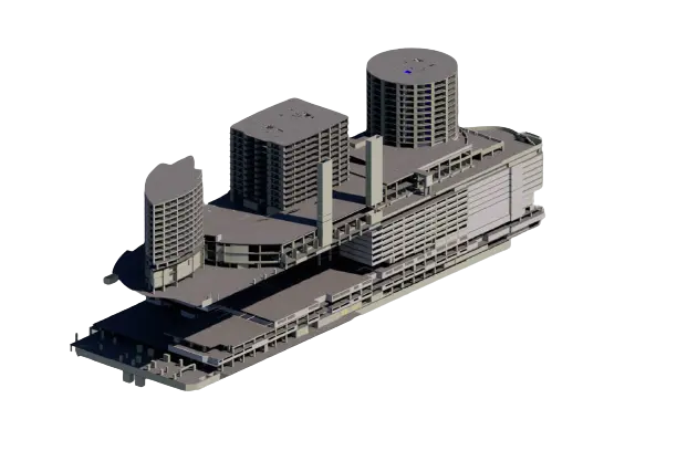
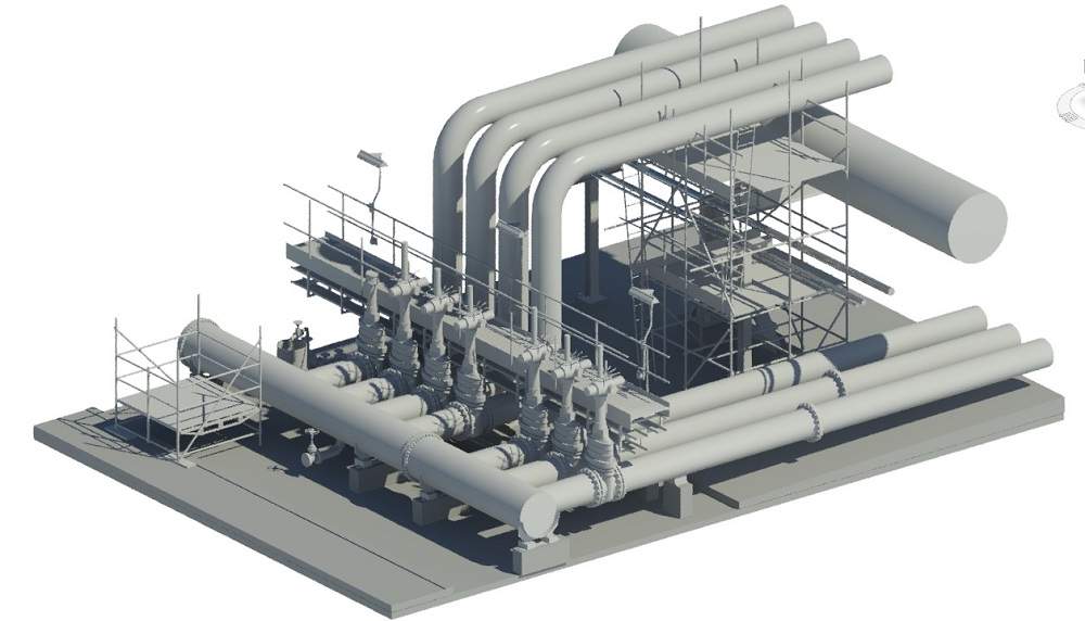
Our Recent Point Cloud to 3D Model Projects
Share Via

Devashish Sharma
Devashish is Founder/Director at Cresire where he leads BIM services. He holds a bachelor’s degree in Civil Engineering from the University of Sheffield and an MSc in Construction Project Management from The University of the West of England. His vision behind CRESIRE is to provide BIM services, adhering to best practices and procedures, to global customers, helping customers to save extensive production costs and overruns.
Our Related Services
