
Scan to BIM Services
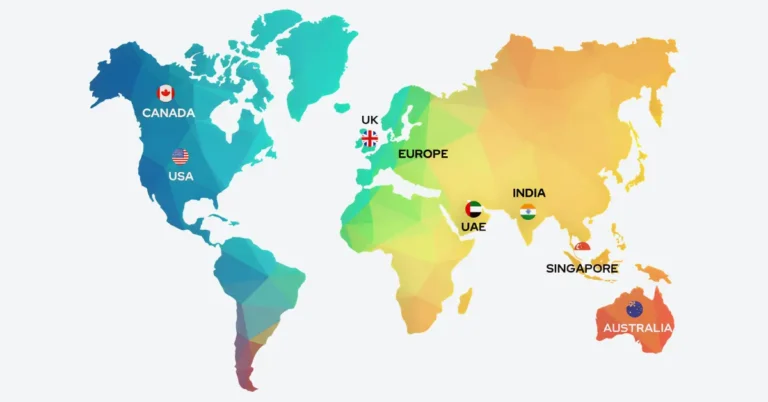
CRESIRE converts point cloud data into accurate BIM models. With 10+ years’ experience, we serve AEC companies globally across the USA, the UK, Europe, and Australia. We model with accuracy (±5mm) with a typical turnaround time between 3 -12 business days. Scan to BIM services Deliverables include RVT, DWG, and IFC models that are used for renovation, as–built documentation, asset management and historical preservation purposes across commercial, residential, and industrial sectors.
QA/QC Verified Deliverables LOD 200-500 2-12 Day Turnaround

⭐ Trusted Globally by surveyors, architects, and construction professionals

Why Traditional Surveys Fail in Modern Construction?
The renovation and facility management projects require accurate existing conditions for effective planning. The common problem of mismatch of drawings with site reality and incomplete building/site drawings bring costly surprises and time overruns that often lead to project failures. All of this happen because of lack of accurate as-built data of a building or a site.
This is where Scan to BIM services eliminate uncertainty by bringing precision. This involves creation of digital 3D information models from point cloud data that contains building’s Architectural, Structural, and MEP elements. This commonly includes elements such as walls, doors, windows, columns, beams, slabs, HVAC, piping, electrical equipment, etc
WHAT IS SCAN TO BIM SERVICES?
Scan to BIM services is the process converting real world site conditions into a precise and intelligent 3D BIM model. This approach uses laser scanning technology to capture exact geometry of a construction space and develop a structured Scan to Revit model.
The physical site or a building is scanned using laser scanning equipment like LiDAR based 3D laser scanners. These device capture millions of data points that create accurate digital representation of building elements known as point clouds.
Next, we the point cloud data is processed and cleaned. We at CRESIRE receive cleaned point cloud data in formats such as RCP and e57. Through point cloud to bim conversion, we convert point cloud data into usable BIM models in Autodesk Revit.

Point Cloud to BIM Modeling Deliverables
We receive point cloud data in either of the below formats and we develop a unified scan by processing the data before point cloud modeling:
E57
RCP
LGS
XYZ
OBJ
FBX
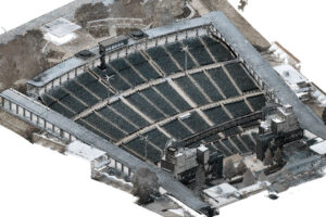
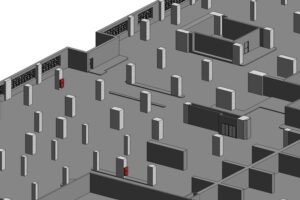
Before
After


BIM Technology Stack


What is considered and delivered in Scan to BIM?
We use point cloud data for developing detailed 3D Revit models. This includes architectural, structural and mep elements defined by scope and intended use. We ensure that our scan to bim deliverables match project goals and design coordination needs.
Point Cloud modeling Process
Initially, we identify the modeling scope and level of detail of building elements (Architectural, Structural and MEP) in point cloud data. We develop BIM Models from LOD 200 (basic) through LOD 300 and 400, up to LOD 500 (as-built).
Consequently, we receive the outsource point cloud modeling commonly in RCP and E57 format. We align the scan data by ensuring all scans are accurately registered into a clear unified point cloud (RCS).
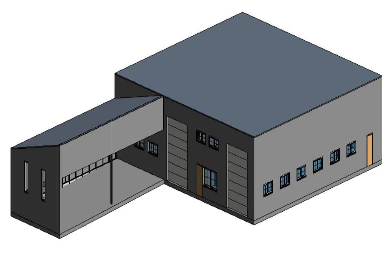
We develop intelligent Revit modeling from the processed point cloud data. We include parametric elements such as walls, floors, structural systems, and MEP components.
Finally, we verify the design elements in the model through point cloud to bim modeling services and site images, ensuring it meets defined tolerances, correct LODs and aligns with real-world conditions.
Revit model (.RVT)
AutoCAD Model (.DWG)
IFC Model
Key Benefits of Scan to BIM Services
- Avoid re-design guesswork with reality-based precision
- Smoother renovations with fewer site surprises
- Reduce redesign costs by improving decision making
- Clash detection ready BIM model for coordination
- Effective retrofit & expansion planning with a clear understanding of present site conditions

Sector We Deliver our Scan to BIM Services
Commercial
Healthcare
Heritage
museum
warehouse
residential
Real Estate
Historic structures
Auditoriums
Amphitheater
manufacturing plants
bridges
Point Cloud to BIM Use Cases
Why Choose CRESIRE for Scan to BIM Services?
We not only create point cloud to revit models, but we also create, simulate and render the output 3D model for superior planning and visualization experience.
- With 10+ years of BIM experience, we specialize in delivering high precision, interdisciplinary Scan-to-BIM services across a wide range of industries.
- Certified Revit modelers backed with Architectural, Mechanical and Civil Engineering qualifications
- Global project delivery. Project focused outsource laser scan to bim services across the USA, UK, Europe and Australia
- Free point cloud review with a detailed quote delivered within 24 hours
- Quick turnaround time. Typical delivery of BIM models within 3-15 business days
- NDA compliance with confidential handling of project data

Our Latest Projects of Point Cloud to BIM Models
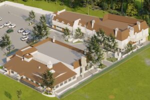
Scan to BIM Services for Renovation
California, USA
LOD 350 Site and Architectural BIM model to support renovation planning and smoother execution.
3D DWG model
Point Cloud to BIM Services for Amphitheater
Missouri, USA
LOD 300 Amphitheater BIM model for effective events planning and minor renovations
3D Revit model
Multi-story Commercial Building Laser Scan to BIM Services
Dubai, UAE
As-Built BIM Models (Architectural, Structural and MEP) of 26 storey building.
3D Revit models and Shop Drawings
Process of Point Cloud to BIM Conversion Explained
Get A Quote Now
About CRESIRE – Trusted Global Scan to BIM Services Provider
CRESIRE provides reliable SCAN TO BIM SERVICES for architects, engineers, contractors, and real estate developers worldwide. Our expertise in point cloud to BIM modeling, scan to BIM conversion, and commercial modeling ensures accurate, coordinated BIM outputs aligned with project goals.
Need a Quote for Point Cloud Modeling Services? Fill in the enquiry form or email us at enquiry@cresireconsulting.com, and our team will contact you soon.
Frequently Asked Questions - FAQs
Do you provide Scan2BIM services for small residential projects?
Yes, we develop Architectural BIM models, floor plans and elevational drawings using laser scanned data for small residential projects.
What are the applications of the Scan to Revit modeling?
The most common applications include as-built models for facility management and renovations. 3d scan to revit modeling facilitates design coordination, construction validation, and clash detection, enhancing teamwork and cutting down on rework.
What is the difference between scan to BIM and CAD to BIM?
Scan to BIM involves using laser scanning technology to capture real-world data and turn it into a 3D digital model. Whereas, CAD to BIM involves development of 3D BIM models in architectural, structural and mep disciplines. CAD to BIM begins with pre-existing 2D drawings, scan to BIM begins with physical reality.
How Long Does Point Cloud Conversion Process Typically Take?
The time required for the conversion process depends on various factors, including the complexity of the point cloud data, the level of detail needed, and the specific requirements of the project. Simple models may be completed in a few days, while highly intricate ones could take several weeks.
Do you model point cloud survey in Revit?
Yes, a lot of people use Revit to model point cloud surveys. Following processing, the laser scan data can be imported into Revit in RCP or RCS formats. The point cloud can then be used to model structural and architectural elements that makes it useful for developing precise as-built BIM models.
Can I export 2D drawings from a Point Cloud Scan to BIM model?
Yes, it’s possible to create 2D CAD drawings such as DWG floor plans, sections, and elevations from a BIM model. Our team includes the building’s design elements into the model and then exports precise DWG files.
What is included in point cloud to BIM conversion services?
Point cloud to BIM conversion services include transforming laser scan data into a structured BIM model with architectural, structural, and MEP components based on agreed LOD specifications.
Which Scan to BIM software tools are available?
There are many software tools available in the market. We use Autodesk tools i.e., Revit, AutoCAD and Recap Pro.
Can Scan to BIM be used for new construction projects?
While Scan to BIM is primarily used for existing structures, it can also be beneficial in new construction for verifying as-built conditions against design intent, ensuring quality control, and creating accurate as-built documentation.
Can I Get Customized 3D Models from Point Cloud Data?
Yes, we model point cloud data in Autodesk Revit software. The software offers features to customize architectural, structural, or MEP design elements for your project. This includes the level of detail (LOD), orientation, shape, and size of building elements. As per your requirement, we also provide different formats of 3D models, such as RVT, IFC, SAT, etc.
What is the cost of Point Cloud to BIM services?
The cost of Point Cloud to 3D Model services depends on several factors, including the total area, design complexity, number of floors, level of detail (LOD), and the quality of the point cloud data. We provide quotes tailored to your specific project needs.
What are the top point cloud modeling software for BIM projects?
AutoDesk Revit, AutoCAD, Leica Cyclone, Trimble RealWorks etc., are popular choices. Recap and Cyclone are recommended for scan processing and registration, whereas Revit is typically used for point cloud modelling. The choice depends on project needs and requires detail.
Can point cloud Scan to BIM be used for all types of buildings?
Yes, Scan to BIM can be used for any type of building. This includes heritage, commercial, industrial, and residential buildings. It is quite helpful in cases where building drawings are out of date or missing. The complexity of design impact the efforts. For example, a simple home requires less detailed modeling than an industrial facility with dense MEP systems.