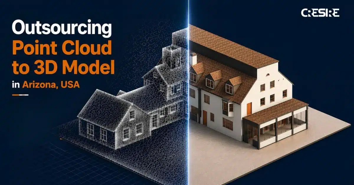
Over the past few years, Laser Scan to BIM in Arizona has quietly evolved from a specialized technique into a mainstream practice across the state’s architecture and construction community. Whether it’s evaluating the current state of a desert home in Tucson or recording a century-old adobe building near Phoenix, this technology is changing how AEC professionals collect and understand real-world building data.
Scan to BIM in Arizona, also known as Point Cloud to BIM, involves using 3D laser scanners to collect millions of precise measurements. These measurements are then turned into an intelligent 3D Building Information Model (BIM). Point cloud modeling offers unmatched accuracy for restoration, retrofit, and historic preservation projects in Arizona, where architecture often showcases history along with modern sustainability.
The comprehensive digital BIM models facilitate confident planning by architects, efficient coordination by engineers, and well-informed maintenance and energy performance decisions by owners.
What’s particularly interesting is how Scan to BIM in Arizona supports sustainable design. By creating highly accurate models of existing structures, teams can evaluate thermal behavior, material efficiency, and passive cooling strategies, especially important for adobe structures and desert homes that respond uniquely to the region’s climate. The result is design that respects tradition while aligning with modern sustainability goals.
While large architectural firms in Arizona have begun developing in-house point cloud to 3D model capabilities, many small and medium-sized studios choose to outsource Scan to BIM services. Outsourcing not only saves time and software costs but also gives firms access to specialists who handle complex laser data with advanced tools and workflows.
In this blog, we’ll explore:
- Trends in advanced point cloud to 3d model in arizona.
- A clear, step-by-step workflow from laser scan capture to 3D BIM data, presented in a simple visual or bulleted format.
- Insights into Arizona’s growing Scan to BIM market, including adoption trends and future projections in the architectural and construction sectors.
Whether you’re an architect planning your next adaptive reuse project or a builder looking to modernize documentation workflows, understanding Laser Scan to BIM in Arizona is no longer optional, it’s becoming a cornerstone of precise, sustainable, and future-ready design.
Top Trends In Advanced Point Cloud To 3D Model In Arizona 2025

1. Point Cloud to 3D model for Adobe Structure
Adobe buildings in Arizona carry stories carved by sun, wind, and time. But their irregular walls and hand-formed textures make traditional surveying tricky. That is where Point Cloud to BIM becomes absolutely useful. By laser scanning these earthen structures, every area is captured with remarkable precision. The resulting BIM model becomes more than just geometry, it is a digital record of history. Architects and conservation teams can study structural health, plan repairs, and preserve authenticity without disturbing the original fabric. It is modern technology quietly protecting centuries-old craftsmanship.
2. Sustainable Design Enabled by Accurate Point Cloud Modeling
True sustainability starts with knowing what’s already there. Using precise point cloud modeling, architects in Arizona can study how a building interacts with sunlight, airflow, and materials before making any design move. This level of detail matters, especially for adobe and desert homes, where even small changes affect comfort and energy use. When that real-world accuracy meets BIM, the result is thoughtful, efficient design that respects the desert environment and the craftsmanship behind it.
3. Mobile & Drone-LiDAR Capture + Edge Computing
In Arizona, mobile and drone-based LiDAR scanning is changing how site data is captured, especially in large desert areas and remote project sites. With edge computing, data can be processed on-site rather than waiting for cloud uploads. This allows surveyors and architects to review precise 3D visuals within hours of scanning. The outcome is faster decisions, fewer delays, and detailed 3D models that accurately represent real-world site conditions.
4. Integration with AR/VR and Digital Twins
The integration of point cloud data with AR, VR, and digital twin technologies is improving the project management activities in Arizona. Architects, engineers and contractors are able to walk through virtual 3D models of buildings before construction even begins on site.
This process promotes identifying potential design clashes that later become expensive rework. Digital BIM models created from accurate point cloud models allow project stakeholders to manage building performance in real time, improving maintenance and operational activities. This combination of technologies is making project delivery smarter, faster, and more collaborative.
How to Convert Scan Data to 3D BIM Data in Arizona?
1. Capturing the Site
To develop a high quality and detailed model it is imperative to capture all the site details. Laser surveyors use high-resolution LiDAR scanners to capture necessary architectural and structural components of the building. The laser scanners capture every wall, floor, beams, columns and roof. For historic adobe structures, even the smallest crack or curve is critical. Using drones for laser scanning helps access rooftops and difficult angles. Handheld scanners take care of the details indoors. This work requires attention, but having a complete scan now avoids many problems later.
2. Aligning Multiple Scans
Usually, one scan isn’t enough. To create a clear dataset, you must combine multiple scans taken from different angles. This process, called point cloud registration, ensures that all doors, walls, and beams match up correctly. It’s like putting together a large 3D puzzle where every piece must fit perfectly.
3. Cleaning and Organizing the Data
Raw scans are untidy. In the laser scanned data you may see furniture, trees, and all other details present in the surrounding. The next step is to remove anything unnecessary while preserving all important architectural elements. By optimizing the point cloud, you can work with it more easily in software such as Revit without causing the system to lag.
4. Modeling in BIM
The true change is about to happen. The team begins tracing walls, floors, roofs, and structural elements after importing the cleaned point cloud into Revit. The objective is to create a 3D BIM model that contains actual data, such as dimensions and materials, so that it can be utilized for planning, remodeling, or building, not just to replicate shapes.
5. Checking Accuracy
The BIM model is compared to the original scans before proceeding. Accuracy is essential in Arizona because older structures and adobe walls can be uneven. This step makes sure the model is as close to reality as possible because even minor discrepancies could later cause serious problems.
6. Adding Details and Metadata
Geometry is only one aspect of a BIM model. Professionals now add systems, materials, and maintenance data. Since project engineers can monitor structural components, architects can plan for design efficiency, and clients can visualise a built asset, the scan to bim model becomes the single source of information. The details included in the BIM model promote sustainable design practices for adobe buildings or desert homes.
7. Collaboration and Delivery
Finally, the BIM model is shared with all the project stakeholders including clients, contractors, engineers, and architects. All project participants use the same references that minimizes errors and improves collaboration. This process of scan to 3d modeling in Arizona guarantees that projects are progressed effectively while project stakeholders stay on the same page.
Why Outsource Point Cloud To 3D Model In Arizona in 2025?
As compared with hiring in-house staff or working with local Arizona providers, outsourcing Point Cloud to 3D Model services offers a more affordable option. The BIM services providers are able to offer competitive pricing as they have a pool of BIM engineers and architects. Because of the hourly rate and wage difference, architectural companies can strategically assign resources, ensuring that funds are used as efficiently as possible.
A large pool of skilled professionals with expertise in Point Cloud to 3D Model services can be found in India. By collaborating with an Indian-based supplier, Arizona architectural firms can get access to these knowledgeable professionals who are well-versed in cutting-edge technologies and industry best practices. Businesses can produce 3D models of outstanding quality with remarkable accuracy and attention to detail by utilizing their expertise.
For architectural companies, outsourcing Point Cloud to 3D BIM Modeling in Arizona can significantly improv productivity and shorten project timelines. Because they frequently work in different time zones, Indian-based providers enable round-the-clock project execution. This benefit results in quicker turnaround times, allowing Arizona architects to fulfill rigorous deadlines and provide clients with projects on time. Architectural firms in Arizona can concentrate on their primary skills such as design innovation, client engagement, and project management.
By outsourcing Point Cloud to 3D Model in Arizona to an India-based service provider, AEC companies in the USA, UK, Europe, and Australia can effectively use internal resources by assigning the advanced task of converting Point Cloud to 3D Models. This practice increases overall productivity and client satisfaction.
Quick Tips for handling large datasets and improving BIM integration
- Don’t load the entire building at once; instead, divide and conquer. Divide the project into sections, floors, or zones. For large desert homes or historic adobe structures in particular, this keeps your software operating smoothly and reduces the overwhelming nature of modeling.
- Clear and Make It Simpler Early: As soon as scanning is complete, eliminate extraneous information such as furniture, trees, or stray objects. Point density should be made as simple as possible. This guarantees you’re working with only what matters, speeds up modeling, and decreases file size.
- Utilize Revit Tools: To concentrate on particular areas and preserve consistency, use section boxes, view filters, and predefined families. This ensures efficiency and accurate integration of BIM elements throughout the model
- Work Together in Real Time: To enable multiple stakeholders to work collaboratively in a single platform, use cloud platforms such as Autodesk Construction Cloud or BIM 360. By keeping everyone in sync, version conflicts are avoided and coordination is enhanced.
- Verify Often: Compare your BIM model to the original point cloud on a regular basis. Early identification keeps your model accurate, prevents errors, and maintains its dependability for renovation, restoration, or sustainable design. Especially when dealing with irregular structures like adobe walls.
Conclusion
Laser Scan to BIM has prominently shaped the process of architectural and construction renovation projects in Arizona. From historic adobe homes to sprawling desert developments, converting point cloud data into editable and detailed 3D BIM models provide precise design information that is critical for any construction projects. Architects make informed design decisions and coordinate with engineers effectively. With Scan to BIM in Arizona, clients gain greater confidence as they are able to assess the design potential and visualise a building or structure before it is built on site.
Outsourcing point cloud to 3D BIM in Arizona has improved the trend, providing AEC companies an access to skilled professionals, faster turnarounds, and cost effective solutions. The software tools such as AutoDesk Revit and drone based LIDAR require advanced skills, Scan to BIM ensures projects are delivered smarter, with fewer errors, and with sustainability in mind.
For Arizona’s AEC community, embracing this workflow isn’t just a technological upgrade, it is a practical, future-ready approach that preserves history, enhances efficiency, and elevates design quality across every project.
Get FREE Quote
For BIM Services for Your Project
Serving Every Continent
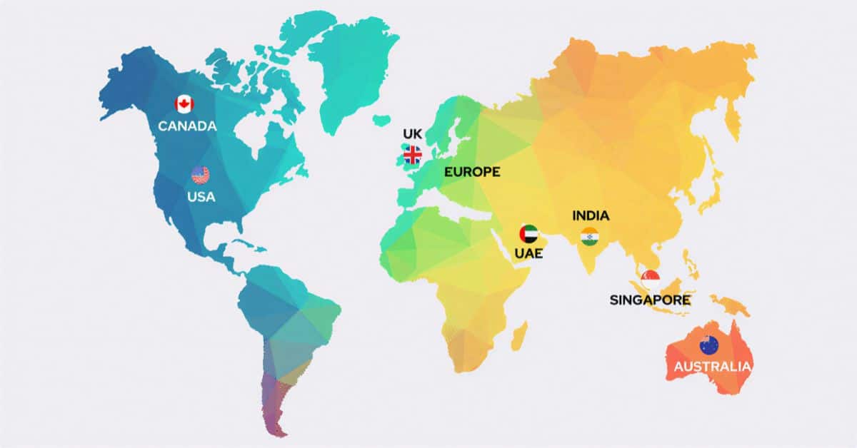
USA & Canada
UK & Europe
Share Via
Tags
- convert point cloud to 3d model, convert point cloud to 3d model autocad, point cloud bim services, point cloud data to 3d model, point cloud model, point cloud modeling, Point Cloud Modeling Services, point cloud to 3d model, point cloud to 3d model in arizona, point cloud to 3d model in arizona usa, point cloud to 3d model in usa, Point Cloud to 3D Model Services

Devashish Sharma
Devashish is Founder/Director at Cresire where he leads BIM services. He holds a bachelor’s degree in Civil Engineering from the University of Sheffield and an MSc in Construction Project Management from The University of the West of England. His vision behind CRESIRE is to provide BIM services, adhering to best practices and procedures, to global customers, helping customers to save extensive production costs and overruns.