Scan to BIM Services - Point Cloud to BIM Modeling
Home / Scan to BIM Services / Scan to BIM Services – Point Cloud to BIM

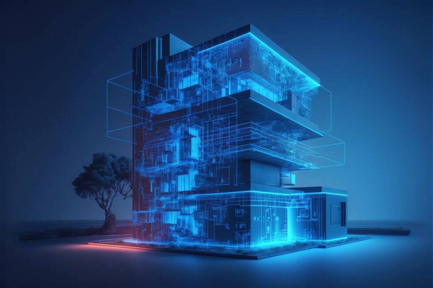
Point Cloud to BIM Services - Scan to BIM Services
We are a BIM Consulting Company, dedicated to empowering AEC (Architecture, Engineering, and Construction) professionals across diverse industries with innovative Point Cloud to BIM Modeling Services and expert guidance.
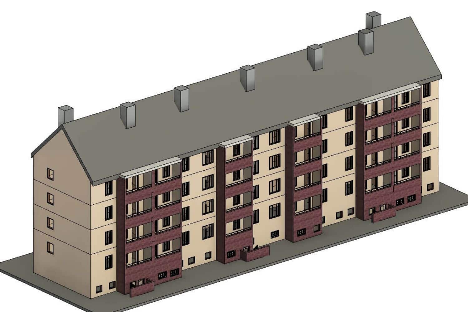
Our specialized Scan to BIM modeling Services offer comprehensive solutions for converting 3D laser scan data into precise, detailed, and intelligent 3D BIM models. Whether it’s renovation projects or new constructions, our project-focused approach ensures efficient project planning, design, and construction processes.
At CRESIRE, we pride ourselves on being Point Cloud Modeling Services experts, providing AEC professionals with the software-based solutions and expertise needed to streamline their BIM workflows and enhance project outcomes.
Our services extend globally, catering to AEC companies in key regions such as the USA, Canada, UAE, UK, Europe (including Germany, and Switzerland, among others), and the UAE.
With a commitment to excellence and client satisfaction, CRESIRE is your trusted partner for all your Point Cloud to BIM needs. Let us help you bring your projects to life with precision and efficiency.
Need a quote for Scan to BIM Modeling Services? Fill in the enquiry form or email us at enquiry@cresireconsulting.com and our team will get in touch with you very soon.
United States
(+1) 757 656 3274
United Kingdom
(+44) 7360 267087
Transforming Scans to Certainty: Scan to BIM Services Guaranteed
Quick Proposals for Point Cloud to BIM Services
Firstly, we respond quickly to initial questions via phone or email! Conversely, supplying you with a price estimate for Point Cloud to BIM Modeling solution. Chiefly that you have provided us with all of the right sets of 3d scanned data
Competitive Pricing
Secondly, our competitive pricing for Point Cloud to BIM Servicesl or Point Cloud Modeling Services helps clients reduce their overhead, operational, and also administrative costs. Consequently, making them competitive in the market
Point Cloud Scan to BIM Software Proficiency
Thirdly, in the architectural, exterior design, and construction fields, we have experts with 8+ years of expertise. We also possess unparalleled expertise concurrently in Revit Scan 2 BIM modeling software, ensuring the accurate and efficient creation of 3D Scan to Revit models for enhanced project management, design, and construction.
Time Zone Alignment for Global Collaboration
Lastly, we bridge the time gap for our clients while offering worldwide multidisciplinary Point Cloud to Revit Modeling Services.
Scan to BIM Services for Diverse Customers
We offer Point Cloud to BIM Modeling Services to customers from diverse industries. Our Point cloud modeling consultants also reviews the laser scans of a built asset and helps our clients to convert Point Cloud to Revit Model.
Consequently, Architects, Civil and MEP Engineers from diverse industries use our services for developing Revit models from a point cloud that they can use for Re-designing, planning, and Facilities Management of a renovation project.
Software We Use for Scan to BIM Services


Our Result-Driven Scan to BIM Services
- Point Cloud Data to 3D Model
- Point Cloud Scan to BIM
- 3D Point Cloud to 3D Model
- Convert Point Cloud to Revit Model
- Lidar Scan to Revit
- Faro Scan to BIM
- Matterport Scan to BIM
Let's Discuss Your Project Requirements
Our Scan to BIM Workflow
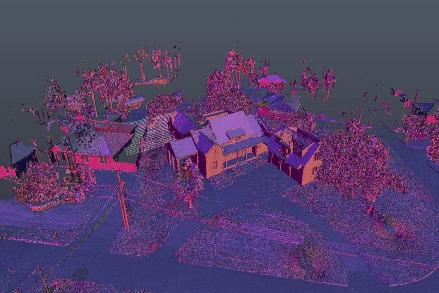
Importing Point Cloud Data
Firstly, we import the point cloud data into Autodesk Recap Pro software. Secondly, we clean and filter the point cloud data in Recap Pro to remove any unwanted noise or outliers.
Registering Point Cloud for BIM Conversion
We also register and align multiple scans if necessary to create a unified point cloud model. Finally, we Export the cleaned and registered point cloud data from Recap Pro in a compatible format (such as .rcp or .rcs).
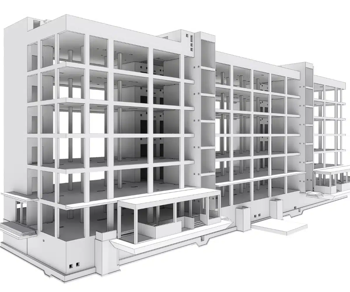
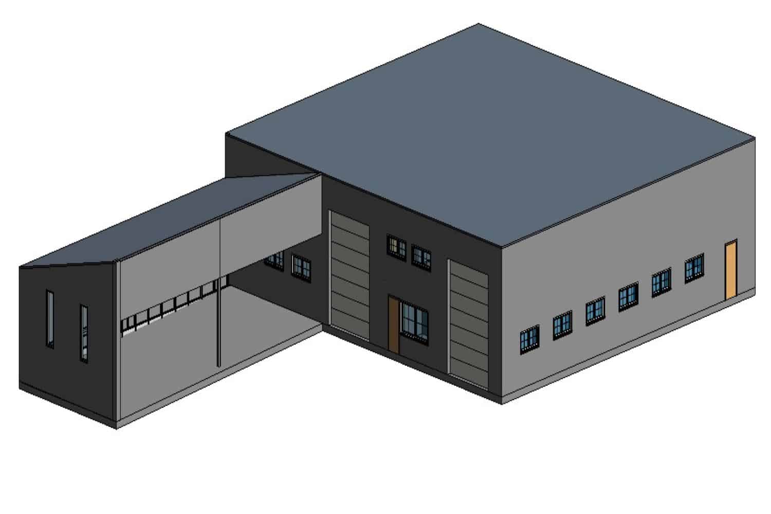
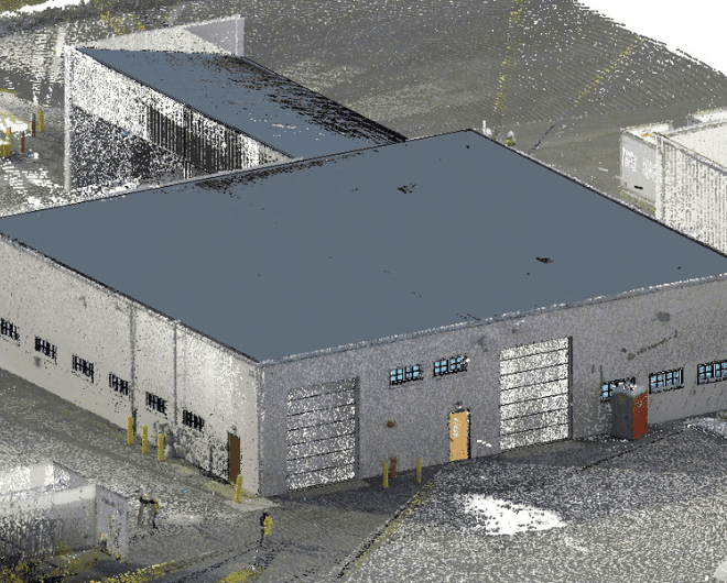
Converting Point Cloud to 3D Revit Model
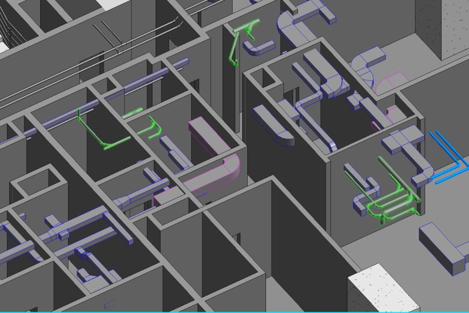
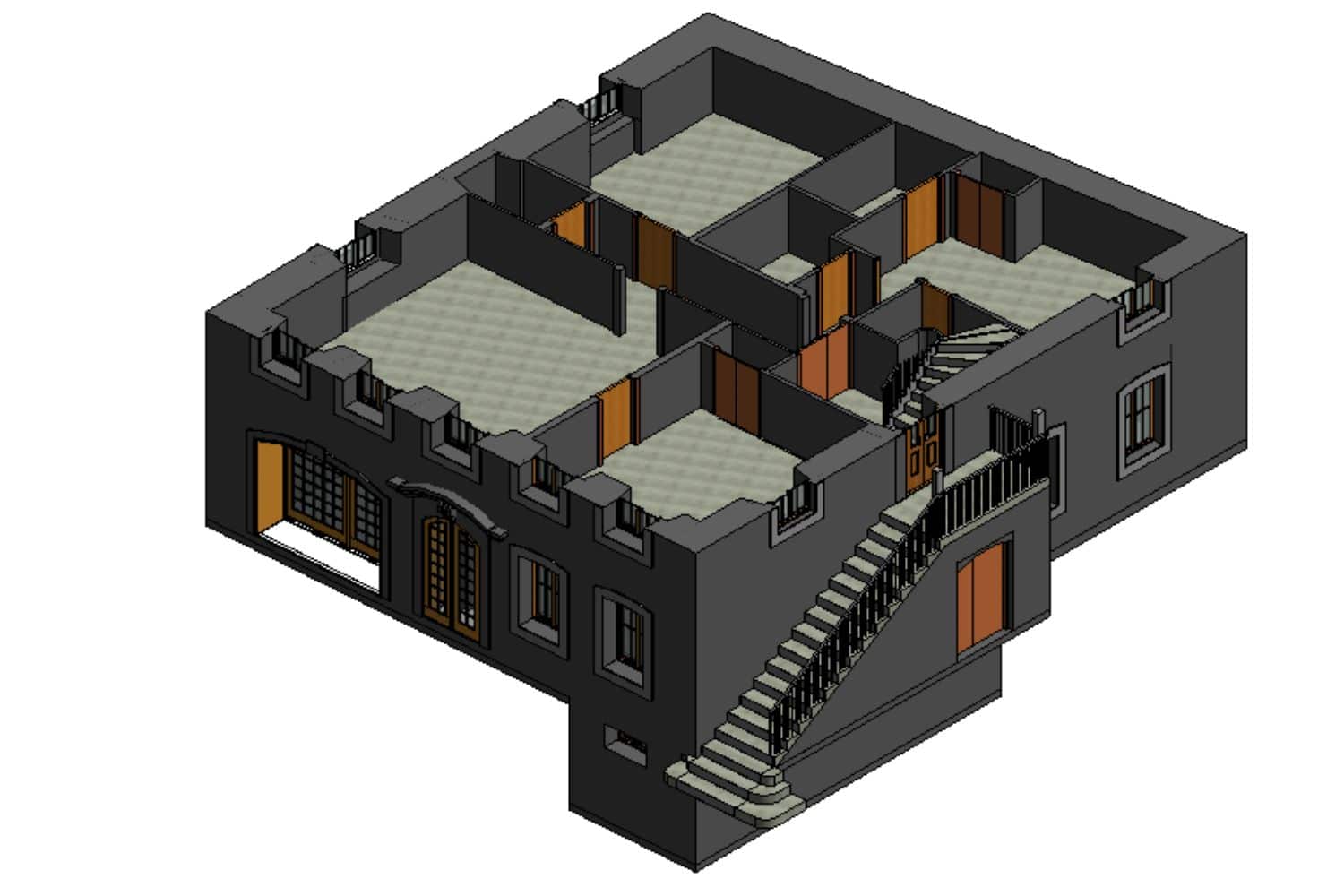
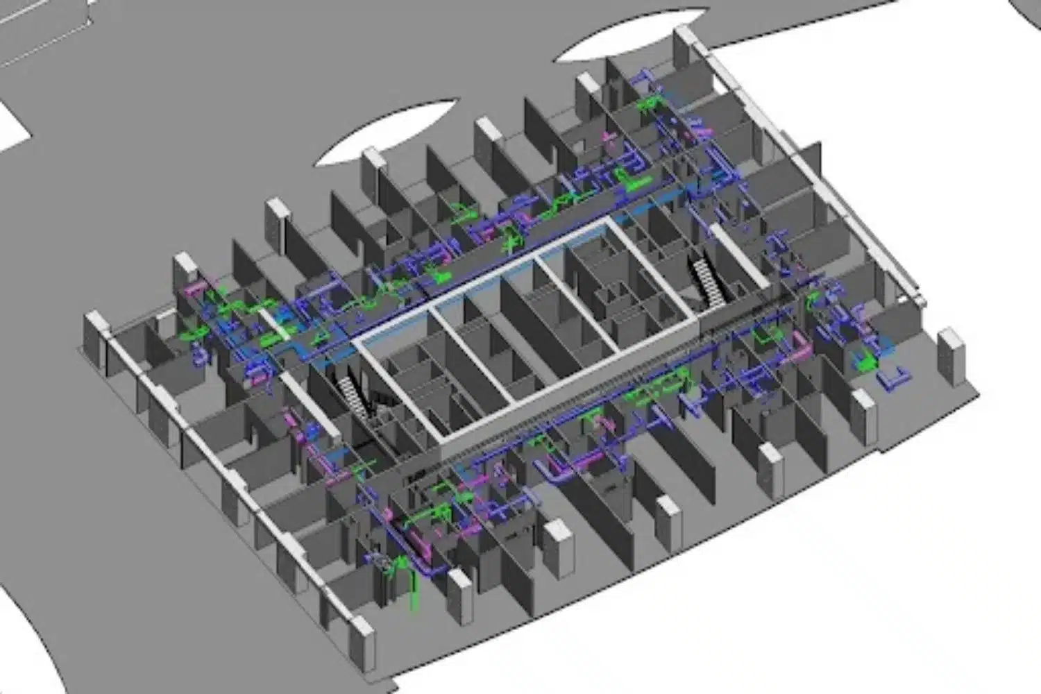
Lastly, we import point cloud data into Revit using the "Link Point Cloud" feature. We define the coordinate system and specify the desired level of detail for the point cloud in Revit. We also use Revit's tools to trace and model BIM elements (walls, floors, ceilings, etc.) over the point cloud.
Exporting Point Cloud to BIM Model
Finally, we export the completed BIM model in the desired format for collaboration or further analysis. Our BIM expert team conduct a final QA/QC before delivering the final Revit model to customers.
How can our Scan to BIM Expertise Transform your Projects?
Visualize Build-Asset with Precision using Scan to BIM Services
-
Extracting deep-seated building elements information
from scanned data - Creating high quality Point Cloud to Revit Model
- Maintaining accuracy by analysing the collected data points
- Identifying design issues to help professionals to reduce construction cost
- Providing detailed visualisation of a building for better decision making
Improve Design Decision for Renovation Projects
- Creating 2D architectural layouts, engineering drawings and designs of old structures using Point Cloud Modeling Services
- Communicating issues in the existing designs to your design team
- Helping visualisation of the new proposed design using architectural modeling software
- Interpreting scanned data with high precision using Point Cloud to BIM modeling services
- Developing accurate 3D models in Revit for integrating As-built data
Let's Discuss Your Project Requirements
Applications of Scan to BIM Services
1. Better Planning of Renovation Projects
Scan to BIM empowers the precise capture of a building’s current state, translating it into a detailed 3D Revit model. This capability is instrumental in generating innovative design proposals and optimizing spatial planning with accuracy and efficiency.
2. Powerful Point Cloud to As-Built Models for Facilities Management
Developing point cloud to as-built BIM models offers precise digital representations of existing structures.
3D Scan to BIM supports facility management by providing comprehensive digital models that aid in asset management, maintenance planning, and space utilization optimization throughout the building’s lifecycle
3. Preservation of Historical Buildings
Laser scanning generates a 3D scanned imagery of the current state of a historical building. Professionals use these scans for developing 3D Scan to Revit Models and DWG drawings.
It integrates 3d design elements and as-built data that are critical for planning and managing the facilities of historical buildings.
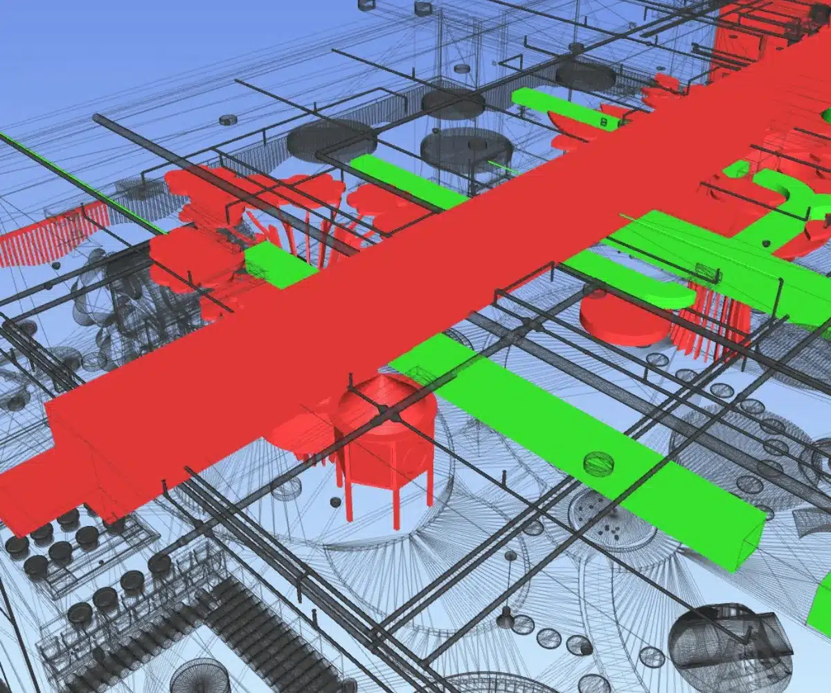
4. Interdisciplinary Clash Detection
3D Scan to Revit allows the development of 3D BIM Models in Architectural, Structural, and MEP disciplines. This enables project stakeholders to identify clashes and inconsistencies between existing conditions and proposed designs, minimizing errors and rework during construction.
Frequently Asked Questions By Our Clients
What is BIM Scanning?
BIM scanning, or Reality Capture, is the process of using laser scanning technology to create precise 3D representations (point clouds) of existing buildings or infrastructure. These point clouds help in generating accurate as-built models, aiding in renovations, retrofits, clash detection, and seamless integration of real-world data into the BIM workflow.
What is point cloud in 3D modeling?
A point cloud in 3D modeling is a set of data points in a three-dimensional coordinate system. It represents the external surface or internal structure of an object, captured by techniques like 3D laser scanning. Point clouds are used as a basis for creating detailed and accurate 3D models of real-world objects or environments.
How are Point Clouds Created?
Point clouds are generated using 3D scanning methods, such as LiDAR (Light Detection and Ranging) or photogrammetry. LiDAR scanners emit laser beams to measure the distance to various points on an object’s surface, while photogrammetry relies on photographs taken from different angles to reconstruct the 3D structure.
Who Uses Point Cloud to 3D Model Services?
Point Cloud to 3D Model Services is utilized by various industries, such as architecture, engineering, construction, archaeology, urban planning, and the entertainment sector. They are valuable for anyone who needs precise and detailed 3D representations of physical objects or environments.
What are the applications of the scan to BIM?
Scan to BIM applications include creating accurate as-built models for renovations, retrofits, and facility management. It aids clash detection, construction validation, and design coordination, improving project collaboration and reducing rework. Additionally, it enables historical preservation and documentation of heritage structures.
What is the difference between scan to BIM and CAD to BIM?
Scan to BIM involves capturing real-world data using laser scanning technology and converting it into a 3D model. CAD to BIM, on the other hand, is the process of transforming 2D CAD drawings into a 3D BIM model. Scan to BIM starts from physical reality, while CAD to BIM starts from existing 2D drawings.
Which technology are you using commonly for scanning in scan to BIM?
We use Laser scanning technology for scanning in scan to BIM. It captures precise 3D data points from the physical environment, creating point clouds that serve as a foundation for generating accurate BIM models of existing buildings or infrastructure.
What is the use of point cloud modeling services and laser scanning technology in the AEC industry?
Point cloud modeling services and laser scanning technology are extensively used in the AEC (Architecture, Engineering, and Construction) industry for capturing accurate as-built data of existing structures. They enable the creation of detailed 3D models, aiding in renovations, clash detection, design validation, and facility management. This technology streamlines workflows, enhances collaboration, and reduces errors in construction projects.
Can I Get Customized 3D Models from Point Cloud Data?
Yes, many Point Cloud to 3D Model Services offer customization options. They can tailor the 3D models to match specific requirements, such as mesh density, level of detail, color mapping, or integration with other software systems.
How Long Does the Conversion Process Typically Take?
The time required for the conversion process depends on various factors, including the complexity of the point cloud data, the level of detail needed, and the specific requirements of the project. Simple models may be completed in a few days, while highly intricate ones could take several weeks.
Is Data Security Ensured During the Process?
Reputable Point Cloud to 3D Model Service providers prioritize data security. They employ encryption methods, secure data transfer protocols, and confidentiality agreements to protect sensitive information. Always ensure to work with trusted and certified service providers to safeguard your data.
What Quality Control Measures are Taken?
Quality control is crucial in the conversion process. Service providers use various validation techniques, like cross-referencing multiple scans, point cloud noise reduction, and visual inspection to ensure the accuracy and integrity of the resulting 3D model.
How Much Do Point Cloud to 3D Model Services Cost?
The cost of Point Cloud to 3D Model Services can vary significantly based on factors like the complexity and size of the point cloud data, the level of detail required, customization, and the service provider. It is best to request quotes from different providers to compare prices and services.
In which states are you providing Point Cloud to 3D Model Services in USA?
California, Texas, New York, Florida, Illinois, Pennsylvania, Ohio, Georgia, New Jersey, Washington, North Carolina, Massachusetts, Virginia, Michigan, Maryland, Colorado, Tennessee, Indiana, Arizona, Minnesota, Wisconsin, Missouri, Connecticut, South Carolina, Oregon, Louisiana, Alabama, Kentucky, Utah, Iowa, and many more.
In which states are you providing Point Cloud to BIM Model Services in UK?
London, South East, North West, East, South West, Scotland, West Midlands, Yorkshire and The Humber, East Midlands, Wales, North East, Northern Ireland.
In which states are you providing Point Cloud Modeling Services in UAE?
Abu Dhabi, Dubai, Sharjah, Ajman, Umm Al-Quwain, Ras Al-Khaimah, Fujairah
In which states are you providing 3D Scan to Revit Services in Germany?
North Rhine-Westphalia, Bavaria, Baden-Württemberg, Lower Saxony, Hesse, Berlin, Rhineland-Palatinate, Saxony, Hamburg, Schleswig-Holstein, Brandenburg, Saxony-Anhalt, Thuringia, Mecklenburg-Vorpommern, Bremen, Saarland.
In which Cantons are you providing 3D Laser Scan to Revit Services in Switzerland?
Zurich, Berne / Bern, Lucerne, Uri, Schwyz, Obwald / Obwalden, Nidwald / Nidwalden, Glarus, Zoug / Zug, Fribourg / Freiburg, Soleure / Solothurn, Basle-City / Basel-City / Basel-Stadt, Basle-Country / Basel-Country / Basel-Landschaft, Schaffhouse / Schaffhausen, Appenzell Outer-Rhodes / Appenzell Ausserrhoden, Appenzell Inner-Rhodes / Appenzell Innerrhoden, St. Gall / St. Gallen, Grisons / Graubünden, Argovia / Aargau, Thurgovia / Thurgau, Ticino / Tessin, Vaud, Wallis / Valais, Neuchâtel, Geneva, Jura.
Email Us
Let's Talk
USA - (+1) 757 656 3274
UK - (+44) 7360 267087
INDIA - (+91) 63502 02061