Looking for the best Point Cloud Modeling Services in New York, NY? Transform raw data into precise 3D models. Get a FREE quote today.
Introduction
Point cloud modeling is gaining popularity amongst architects, engineers, facilities managers, surveying, and construction companies in New York in the present day and age.
The professionals are utilizing the latest innovation for surveying an existing building for renovation and facilities management purposes. Point Cloud Scan to BIM has a significant impact on the design development and management that leads to cost and time certainty.
Several large companies in New York, USA have in-house BIM capabilities for developing REVIT models and 2D CAD drawings using laser-scanned data.
However, many companies prefer to partner with a BIM consultant for point cloud modeling to augment their in-house team and achieve their project timeline.
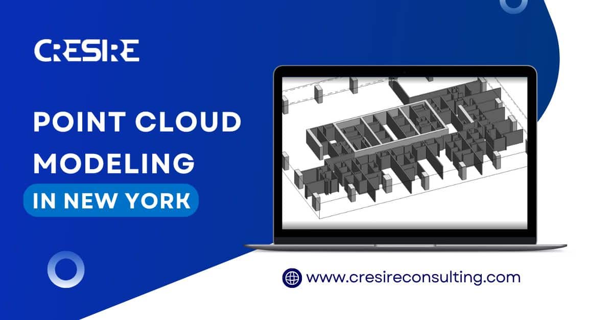
CRESIRE offers comprehensive Point Cloud Modeling in New York, USA. Our team of experienced professionals is dedicated to providing high-quality and accurate Point Cloud Modeling Services in New York, NY for a wide range of industries.
Whether you are involved in Architecture, Engineering, Construction, or any other field that requires precise 3D models, our services are tailored to meet your specific needs.
With our advanced technology and expertise, we guarantee exceptional results that will help you streamline your projects and achieve your goals.
Serving Every Continent
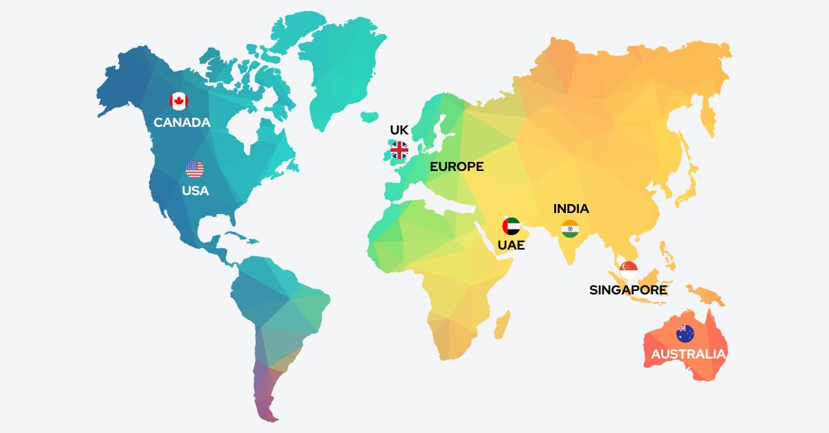
USA & Canada
UK & Europe
Point Cloud Modeling Services Offered by CRESIRE in Diverse Sectors
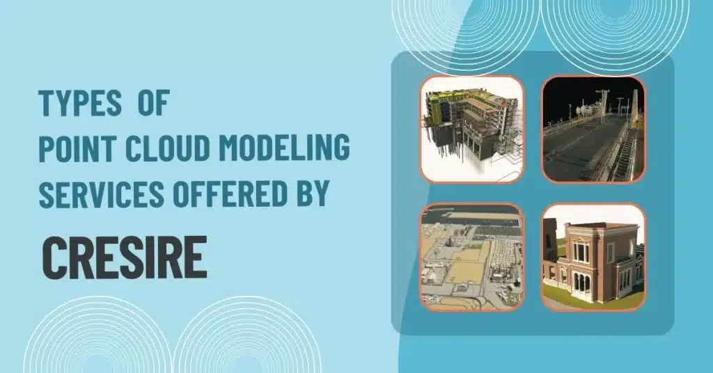
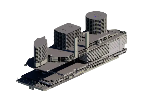
1. Building Information Modeling - BIM
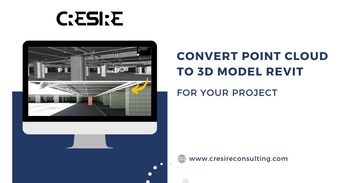
Our BIM Point Cloud Modeling Services in New York, NY enables the creation of accurate and detailed 3D models of existing buildings.
By using laser scanning technology, we capture precise measurements and Convert Point Cloud Data to 3D Model Revit. BIM models allow for improved visualization, clash detection, and efficient collaboration during the design and construction phases.
2. Infrastructure Point Cloud Modeling
Our point cloud to BIM services in New York for infrastructure projects provides accurate 3D representations of roads, bridges, tunnels, and other civil structures.
This enables engineers and designers to analyze existing conditions, plan renovations or expansions, and identify potential conflicts before the construction process begins. With our expertise, we ensure that your infrastructure projects are executed smoothly and with reduced risks.
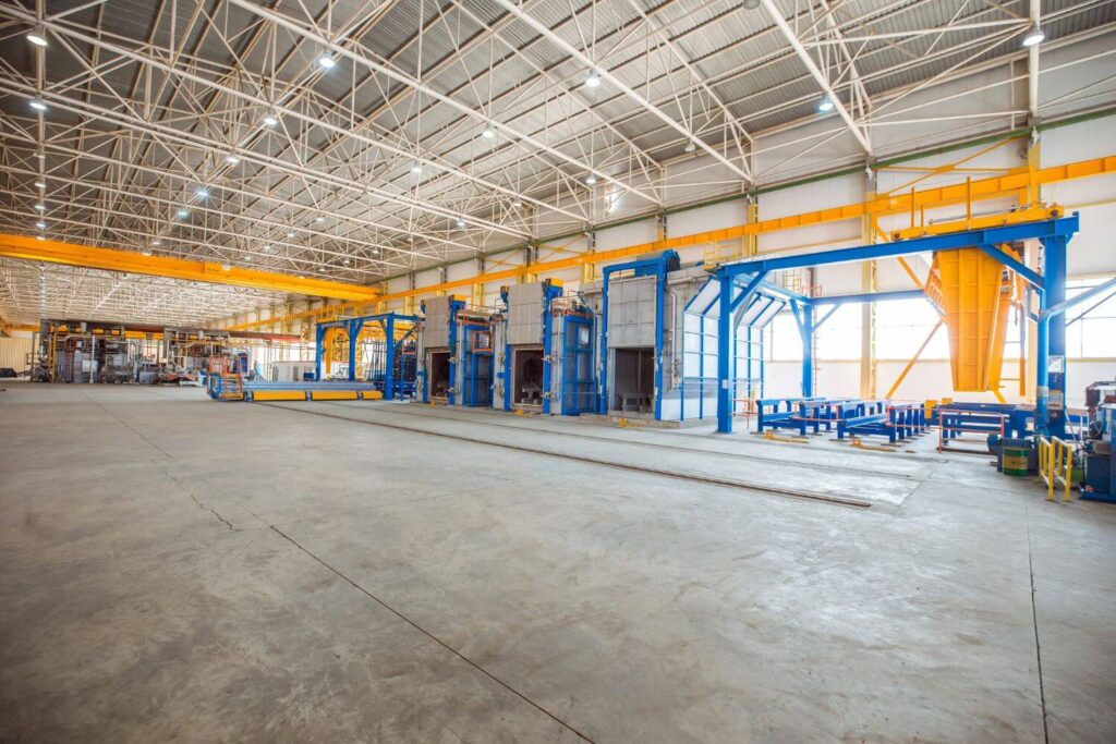
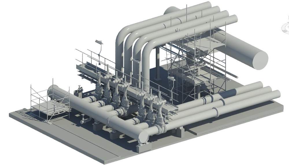
3. Industrial Modeling
Our industrial Point Cloud Modeling Service in New York, NY is specifically designed for factories, plants, and manufacturing facilities.
By capturing detailed 3D data of the existing site, we can create models that help optimize processes, plan equipment layouts, and enhance safety measures. Our industrial modeling solutions contribute to increased productivity and cost savings for your operations.
4. Heritage and Cultural Preservation
Point cloud modeling plays a crucial role in the preservation of heritage sites and cultural artifacts. With our specialized service, we can create accurate 3D models of historical buildings, monuments, and sculptures.
These models aid in restoration projects, documentation, and virtual tours, ensuring the conservation of cultural heritage for future generations.
What are the Advantages of Point Cloud Modeling?

1. Design Certainty for Project Stakeholders
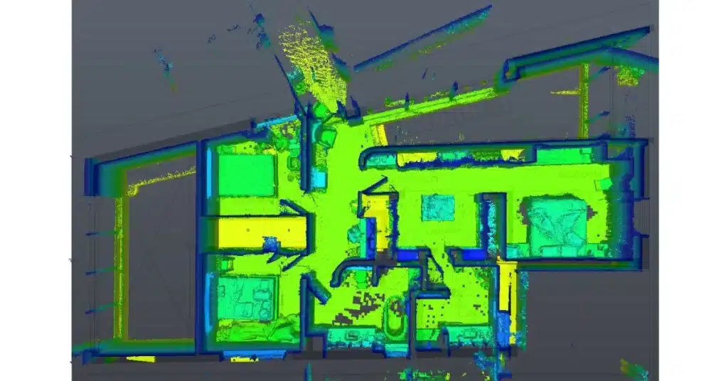
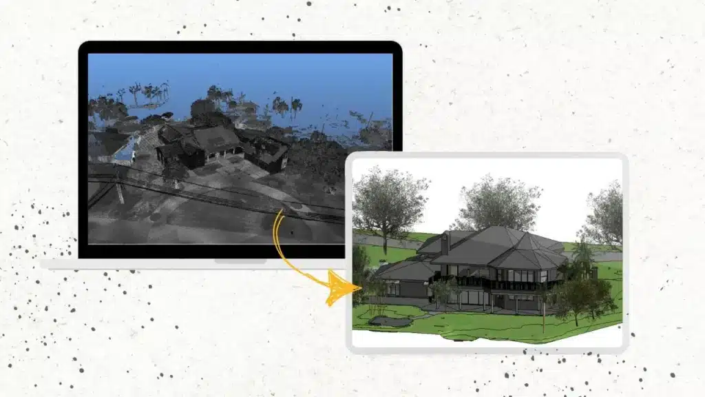
Point cloud scan provides a high level of accuracy by capturing millions of individual data points. These points combine to form a virtual representation of a building.
The scans are imported in point cloud processing software for registration. Using the registered point cloud data in a compatible format in Revit allows BIM engineers to develop precise 3D models.
The precision ensures that your 3D Models are an exact representation of the real-world environment, reducing errors and improving project outcomes.
2. Realistic Visualization of a Site
Point cloud modeling allows you to create an as-built building and site condition in Revit software.
The 3D Revit models are developed in architectural, structural, and MEP disciplines. The Point cloud scans are powerful because they hold critical design details such as precise location, orientation, dimensions, etc.
Point Cloud scans allow designer professionals to model and render the as built conditions of a building, leading to realistic and immersive visualization of complex structures and environments.
Scan to BIM Services in New York helps stakeholders gain a better understanding of the project, identify potential issues, and make informed decisions.
3. Promoting Collaboration Among the Design Team
Point cloud modeling leads to the creation of precise 3d information models in different disciplines.
The 3D Revit models are being shared with different stakeholders for review, collaboration, and feedback purposes.
The approach promotes better collaboration than traditional practices because, with a shared 3D model, all stakeholders can easily visualize and communicate ideas, resulting in good coordination, reduced clashes, and improved productivity.
4. Improving Cost and Time Certainty of Projects
The speed and efficiency of laser scanning technology allow professionals to gather existing site data more efficiently than traditional practices.
Using advanced software such as Recap Pro and Revit for point cloud data processing and 3D modeling respectively allows AEC professionals to develop accurate design models, 2d drawings, and cost estimates that in turn save significant costs and time overruns that may occur due to design changes, inaccurate cost estimates and site clashes.
Why do Architects Need Point Cloud Modeling?
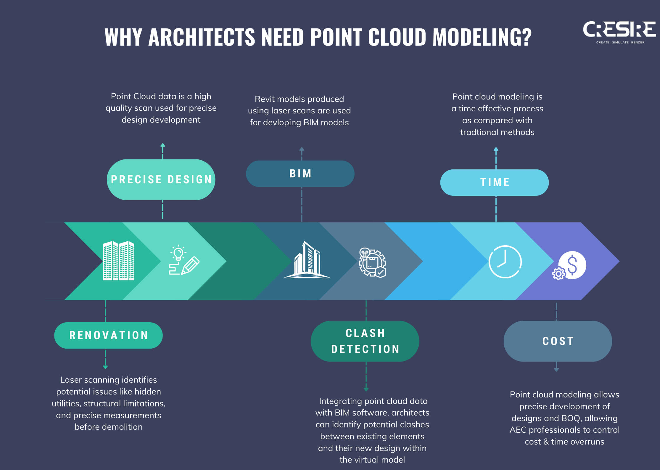
For any construction project, architects have the most design responsibility. With bigger responsibilities come bigger challenges.
An educated or well-acquainted client demands precision, quick turnaround time, and superior deliverables. This is where point cloud modeling comes in, allowing architects to offer superior deliverables to their clients than traditional practices.
Here’s why architects are increasingly relying on point cloud modeling to solve modern architectural problems:
1. High-Quality Data for Precise Design Development
For any project, traditional methods like manual measurements and 2D drawings can be time-consuming, prone to errors, and miss crucial details.
Point cloud modeling allows architects to develop accurate 3D representations of the entire space, capturing every nook and cranny with millions of data points. This allows Architects to demonstrate their design ideas in a three-dimensional manner, making it easier for their clients to review and share feedback on design ideas.
Not only that, using point cloud modeling architects are confident about the design precision achieved in the 3D Revit Model. Achieving the model precision helps architects to develop accurate 2D plans, elevations, shop drawings, etc for a project.
2. Well Planned Renovation
As an architect, reworking existing buildings often requires reviewing complex layouts and unexpected site conditions.
Adapting laser scanning helps architects to develop a virtual walkthrough of the existing structure, allowing them to identify potential issues like hidden utilities, structural limitations, and precise measurements before demolition begins.
To gain more certainty on the conditions before demolition, architects often develop 3D Revit models to visualize the site conditions more effectively. This leads to a well-planned and accurate design plan and avoids costly changes during construction.
3. Integrating BIM and Clash Detection
It is often the responsibility of an architect to develop a BIM model for a project. It is therefore their responsibility to design and deliver an information model, containing the required details of the design elements.
By integrating point cloud data with BIM software, architects can identify potential clashes between existing elements and their new design within the virtual model.
Not only that, architects can coordinate their proposed design with structural and MEP disciplines by conducting clash detection in software such as Navisworks. This provides a comprehensive report of the clashes occurring at different locations/levels of a building.
Making it easier for Architects to coordinate and eliminate design clashes before the project goes on-site. This proactive approach minimizes site issues and rework costs during construction.
What is the Need of Point Cloud Modeling Services in New York, NY?
In a bustling city like New York, point cloud modeling services are in high demand due to several factors:

Urban Planning
With ongoing urban development and infrastructure projects in New York City, point cloud modeling offers a precise and efficient way to assess existing conditions and plan future developments.
It helps in evaluating site feasibility, optimizing space utilization, and ensuring compliance with building regulations.
Historical Preservation
New York is renowned for its rich history and iconic landmarks. Point cloud modeling services in New York enables the preservation and documentation of historical sites, facilitating restoration projects and accurate archival records.
Architecture and Construction
The architectural and construction industries in New York greatly benefit from Point Cloud to BIM Modeling.
It enables architects and engineers to capture as-built conditions, perform clash detection, and create detailed construction plans, resulting in streamlined processes and improved project outcomes.
Real Estate and Property Management
Point cloud modeling provides valuable data for real estate professionals and property managers in New York, NY.
Accurate 3D models assist in property assessment, space planning, and tenant customization, ensuring efficient utilization of commercial and residential spaces.
Our Point Cloud Modeling in New York, USA offer a wide range of benefits and cater to the specific needs of various industries.
Whether you require building information modeling, infrastructure modeling, industrial modeling, or heritage preservation, our team of experts is equipped to deliver exceptional results. Embrace the power of Point Cloud to BIM Modeling and revolutionize your projects with our advanced solutions.
Also Read, 5 Benefits of Outsourcing Point Cloud to 3D Modeling in California
Frequently Asked Questions - FAQs
What is point cloud modeling in New York?
Point cloud modeling in New York refers to the process of capturing and creating digital representations of real-world environments or objects using a collection of data points in three-dimensional space. This technology is commonly used in urban planning, architecture, and construction to create detailed and accurate models of buildings, streets, and landscapes in New York City.
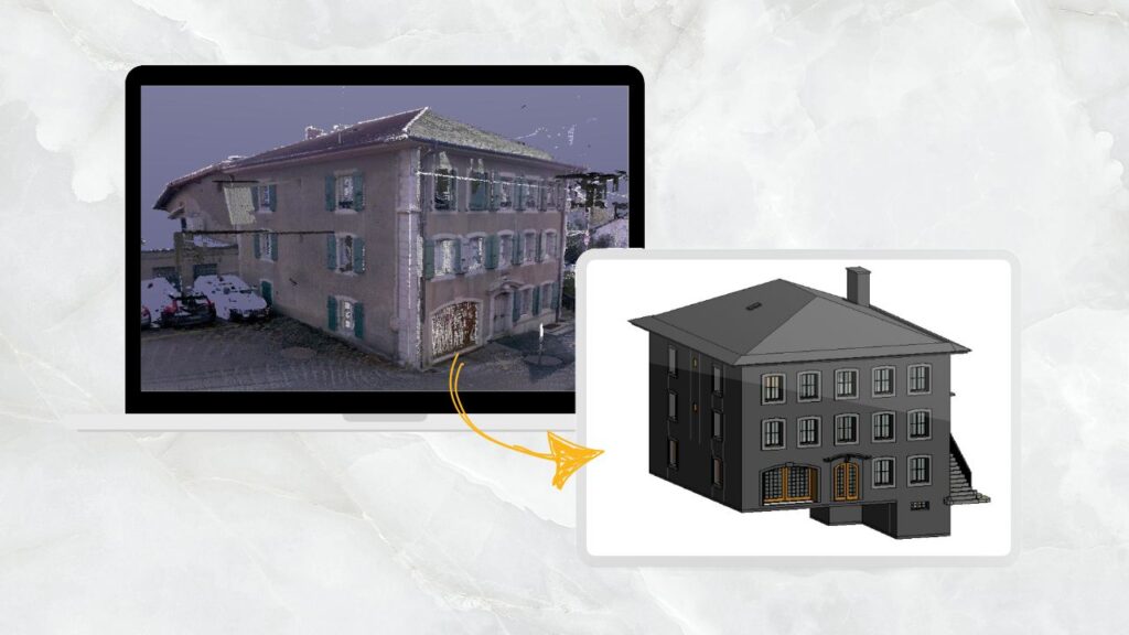
How do you convert point cloud to 3D model?
To convert a point cloud to a 3D model, you use software like AutoCAD, Revit, or specialized tools like CloudCompare. The process involves importing the point cloud data, cleaning it, and then generating surfaces or solids from the points to create a 3D representation. This process allows for visualization and further design work.
In which cities are you providing Point Cloud Modeling Services in New York, NY?
New York city, Hempstead town, Brookhaven town, Islip town, Oyster Bay town, Buffalo city, North Hempstead town, Babylon town, Rochester city, Yonkers city, Huntington town, Ramapo town, Syracuse city, Amherst town, Smithtown town, Albany city, Greece town, Greenburgh town, Cheektowaga town, Clarkstown town, Colonie town, New Rochelle city, Tonawanda town, Mount, Vernon city, Southampton town, Schenectady city, Utica city, Hamburg town, Clay town, White Plains city, and Many more cities.
Related Posts


Our Recent Point Cloud / Scan to BIM-Revit Projects
Share Via
Tags

Devashish Sharma
Devashish is Founder/Director at Cresire where he leads BIM services. He holds a bachelor’s degree in Civil Engineering from the University of Sheffield and an MSc in Construction Project Management from The University of the West of England. His vision behind CRESIRE is to provide BIM services, adhering to best practices and procedures, to global customers, helping customers to save extensive production costs and overruns.
Recent Post
Our Services